What is SuperDARN?
The SuperDARN Community
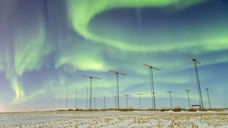
The northern lights seen over the Saskatoon SuperDARN radar site. (Credit: Ashton Reimer)
The Super Dual Auroral Radar Network (SuperDARN) is an international network of high-frequency (HF) radars located throughout the northern and southern hemispheres. SuperDARN is operated and maintained by an international collaboration of universities and research institutions located throughout the world. The purpose of SuperDARN is to study plasma in the near-Earth space system; its interaction with the Earth's atmosphere and geospace environment; its effects on the terrestrial “hard” infrastructure (e.g. communications, energy, transportation, etc…); and its role in the Sun-Earth system.
The Ionosphere
Above about 100 km altitude, the atmospheric gas becomes quite rarified, and a plasma of electrically charged particles exists. This is a natural part of the Earth’s upper atmosphere, and the electrically charged layer is called the ionosphere. The motion of the charged particles in the ionosphere and throughout the solar system is controlled primarily by electromagnetic forces. Forces on the charged particles in the ionosphere and in near-Earth space are imposed by the fast flowing solar wind plasma and the interplanetary magnetic field, which emanate from the Sun out through the solar system.
Similar to how atmospheric weather is driven by high and low pressure systems, space weather is driven by high and low voltage systems. The SuperDARN plasma circulation maps are an essential input to solar system science.
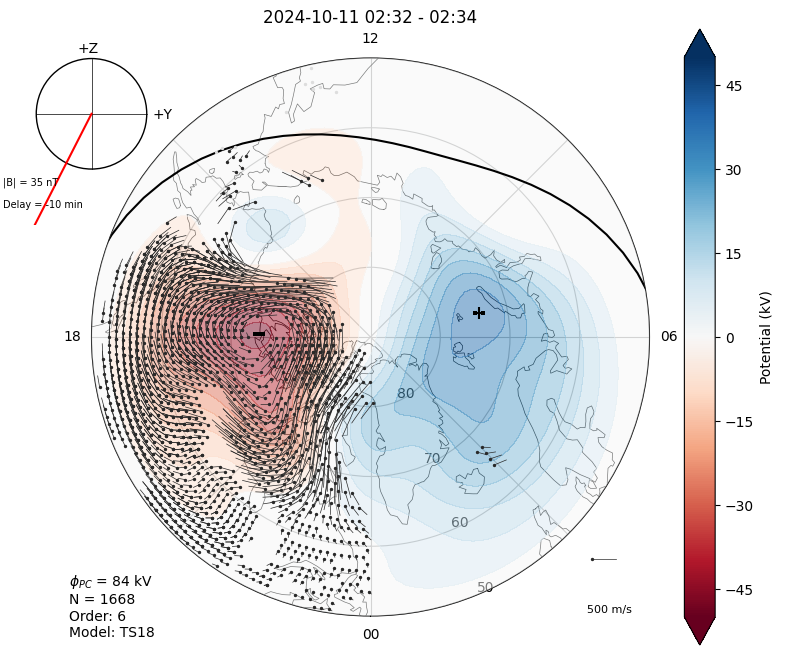
A plasma circulation map produced by the SuperDARN network. The contours indicate voltage magnitude, which describe the plasma flow speed. This is similar to how pressure contours indicate wind speed on weather maps.
The SuperDARN Radars
The 40+ radars used in the global coverage of SuperDARN, are high-frequency coherent scatter radars, used to study field-aligned ionospheric irregularities. This means that all of the SuperDARN radars send out radio waves, which then bounce off the ionosphere and return to be read by the radar. This is the same process by which you can hear radio in your car, but for our radars they bounce off specific irregularities which are changes to the density of the ionosphere which are aligned with the magnetic field of the Earth.
When the radio wave is returned back to the radar, the information it carries can tell how fast the irregularity is moving with respect to the direction of the radar's field of view (i.e. if the irregularity is coming towards or away from the radar). When we compound lots of overlapping radars, we get lots of measurements of the movement of the ionosphere, and as such we can build up a picture of how the ionosphere is moving as a whole in the polar regions, just like the diagram above.
This data is then used to study the effects of solar wind on Earth's ionosphere, which in turn will lead to developing protection and prediction of space weather, learn more about how important SuperDARN is for space weather prediction here.
Northern Hemisphere Radars
Southern Hemisphere Radars
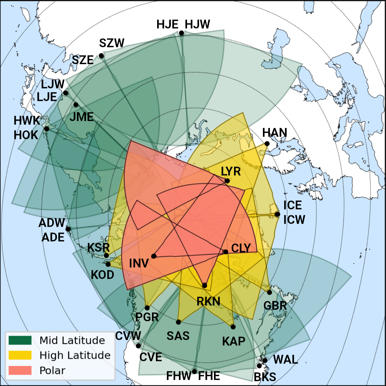
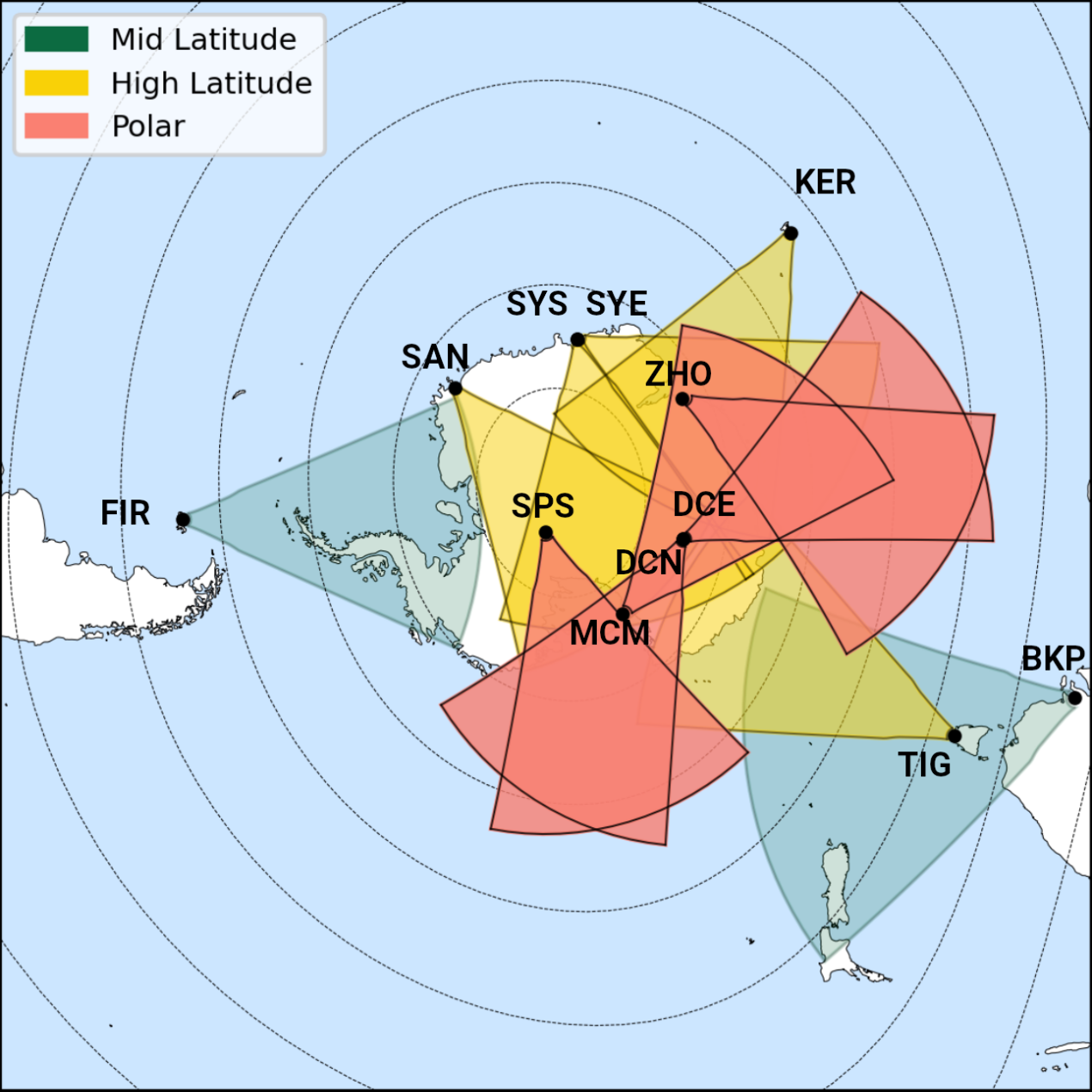
The above diagrams show field of view in grey for each radar in the Northern (left) and Southern (right) hemispheres. In the Northern hemisphere, SuperDARN Canada managed radars have a red field of view. Both diagrams are viewing Earth from above the corresponding geographic pole, where the concentric ovals are showing the geomagnetic latitude. Each black dot is a radar station, labeled by its unique 3 letter code. The landmasses are shown in white.
The ultimate goal is to produce a unified space weather model that, given space weather conditions at the Sun, can predict what will happen in the Earth’s atmosphere (including plasma circulation, auroral displays, and changes to GPS signal quality) and even down into the ground where electrical currents are induced. Read more about space weather here!