Radar Lookup Table
Below is a list of all SuperDARN radars separated by hemisphere.
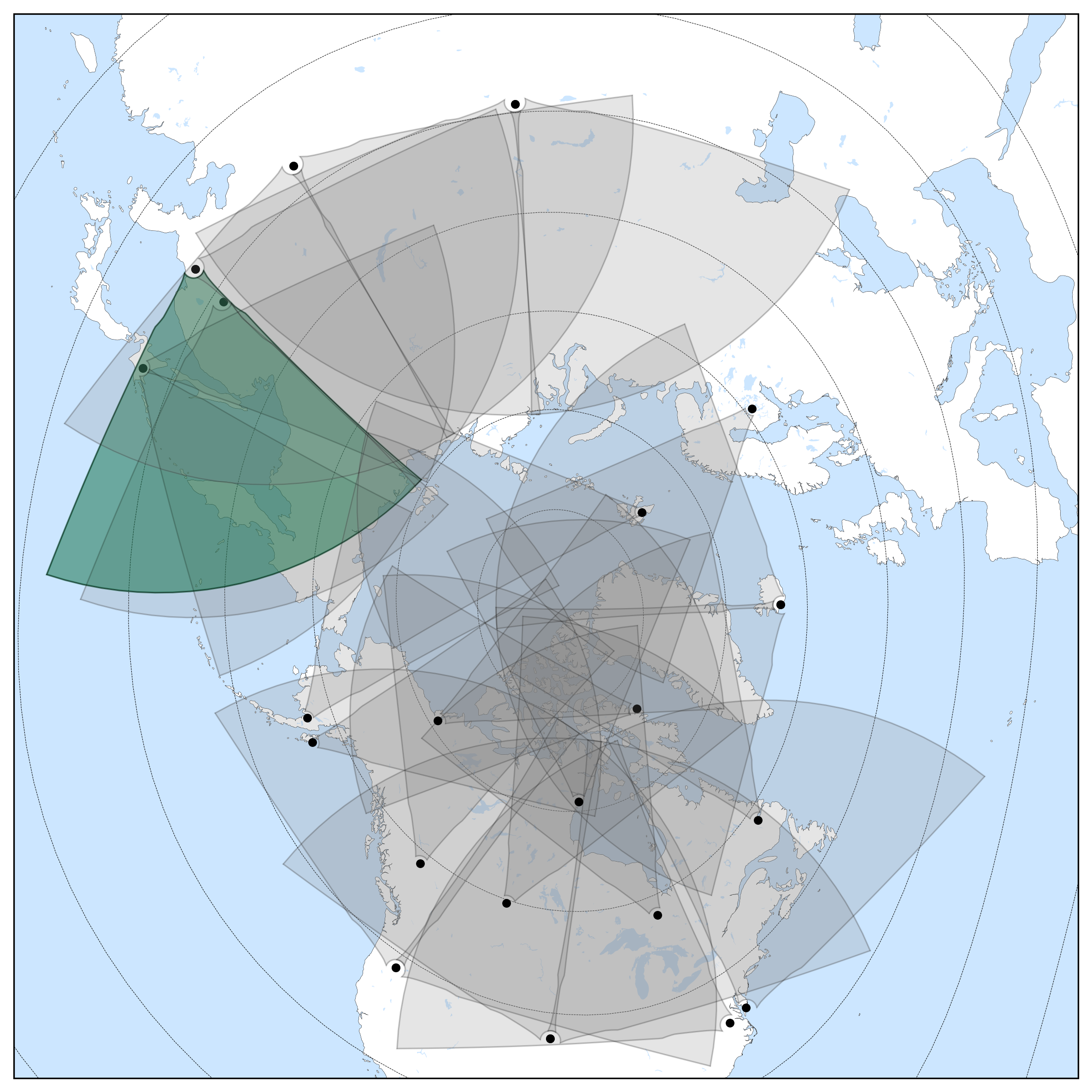
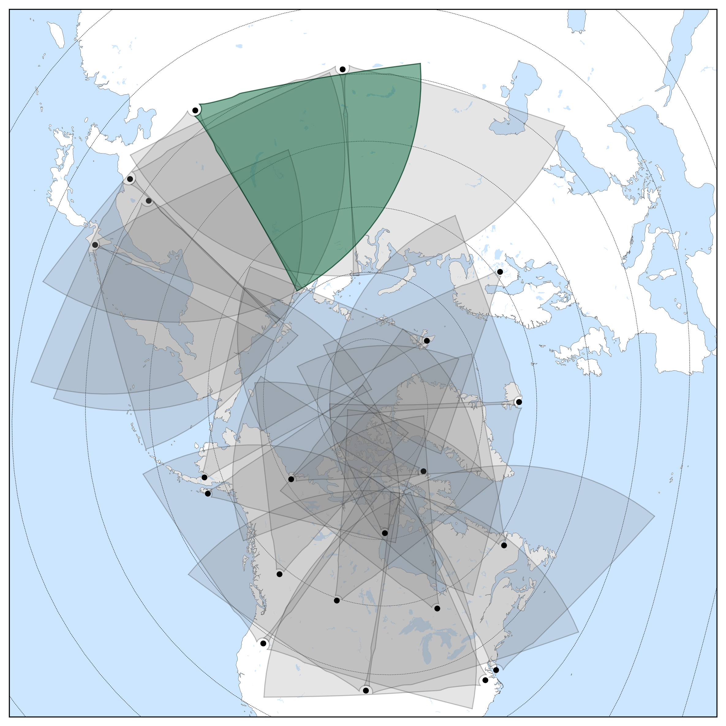
In the table, SuperDARN Canada radars are highlighted in green. Radars that no longer exist physically at a location (decommissioned) are shown in red. Radars which have not contributed data to the data mirrors for at least one year are shown in grey (this could be for many reasons, e.g. it is undergoing repairs or in the process of decommissioning).
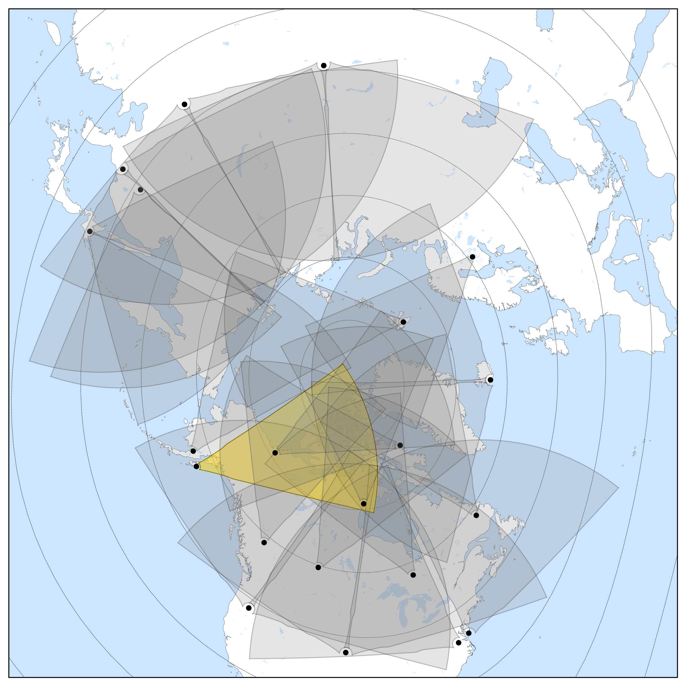
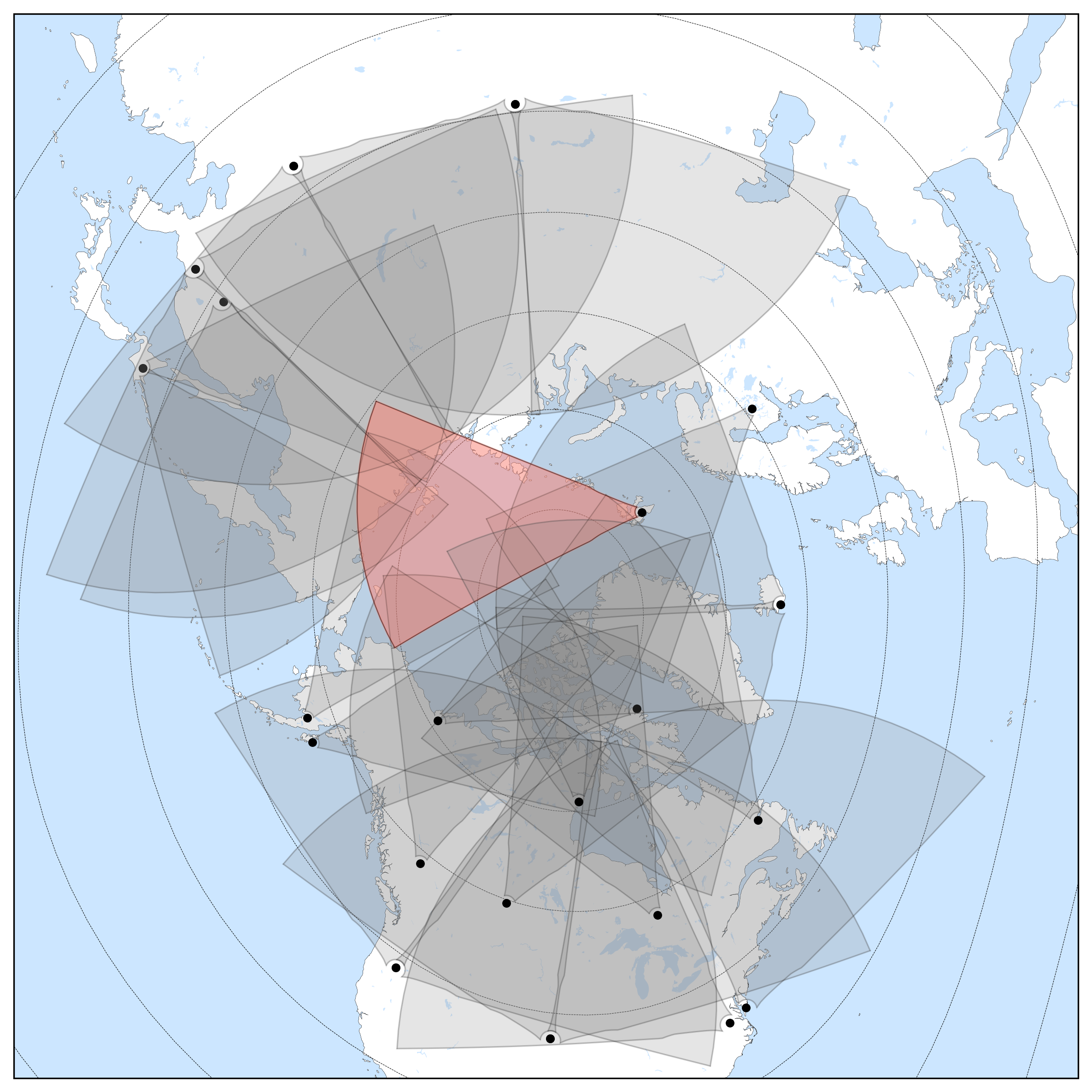
Click on each radar name to open an overview of the radar, a diagram of its field of view from above the corresponding geographic pole, and current technical information. Descriptions of each parameter given are discussed in the table at the bottom. Linked are the PI for each radar and their institution for
further information.
The values for magnetic coordinates presented here are calculated using AACGM coordinates, and may deviate from the exact true value at time of reading. We advise that you calculate your own Geomagnetic coordinates for the specific time periods of your study if being used for scientific purposes, the values quoted here are for general reference only. Last update: 1st
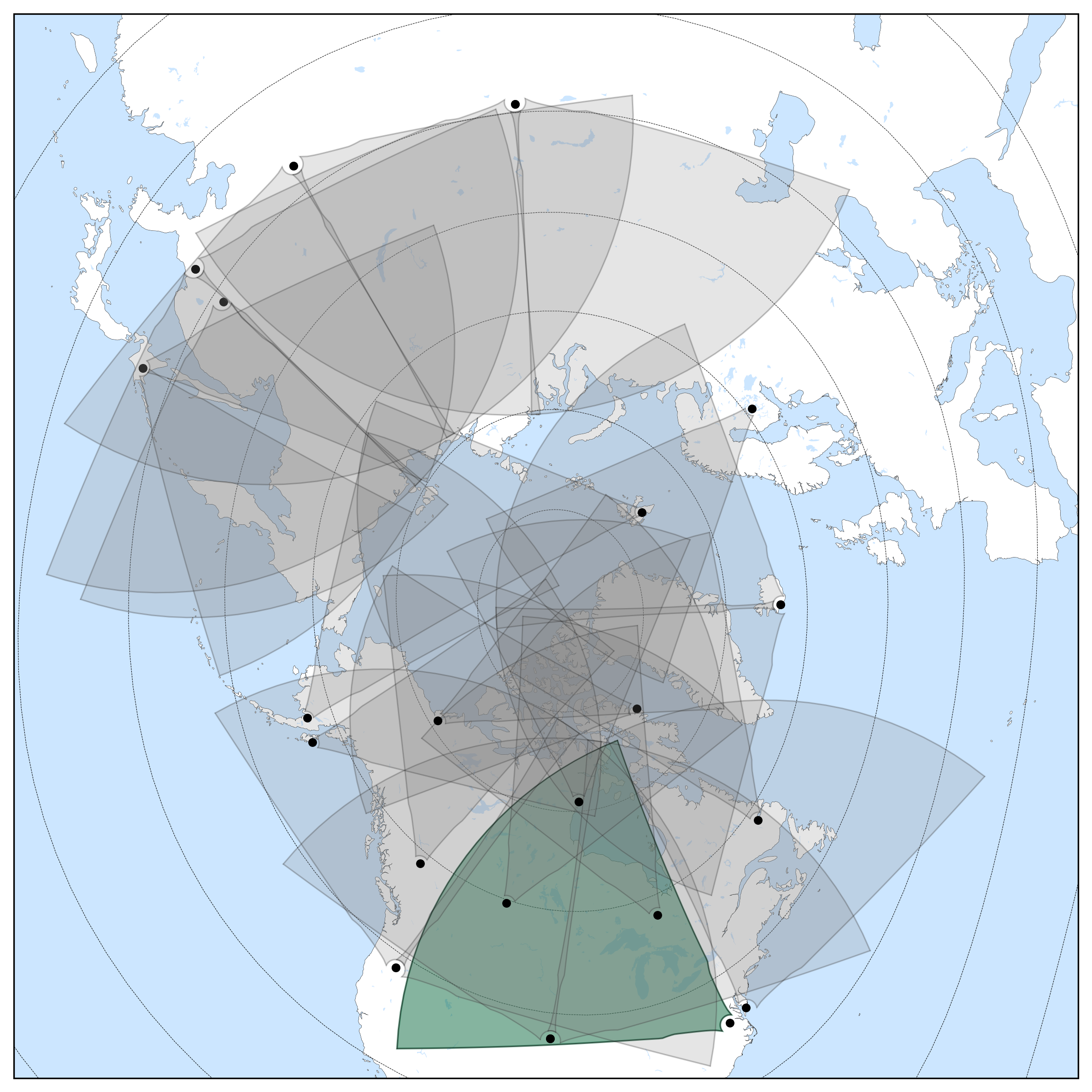
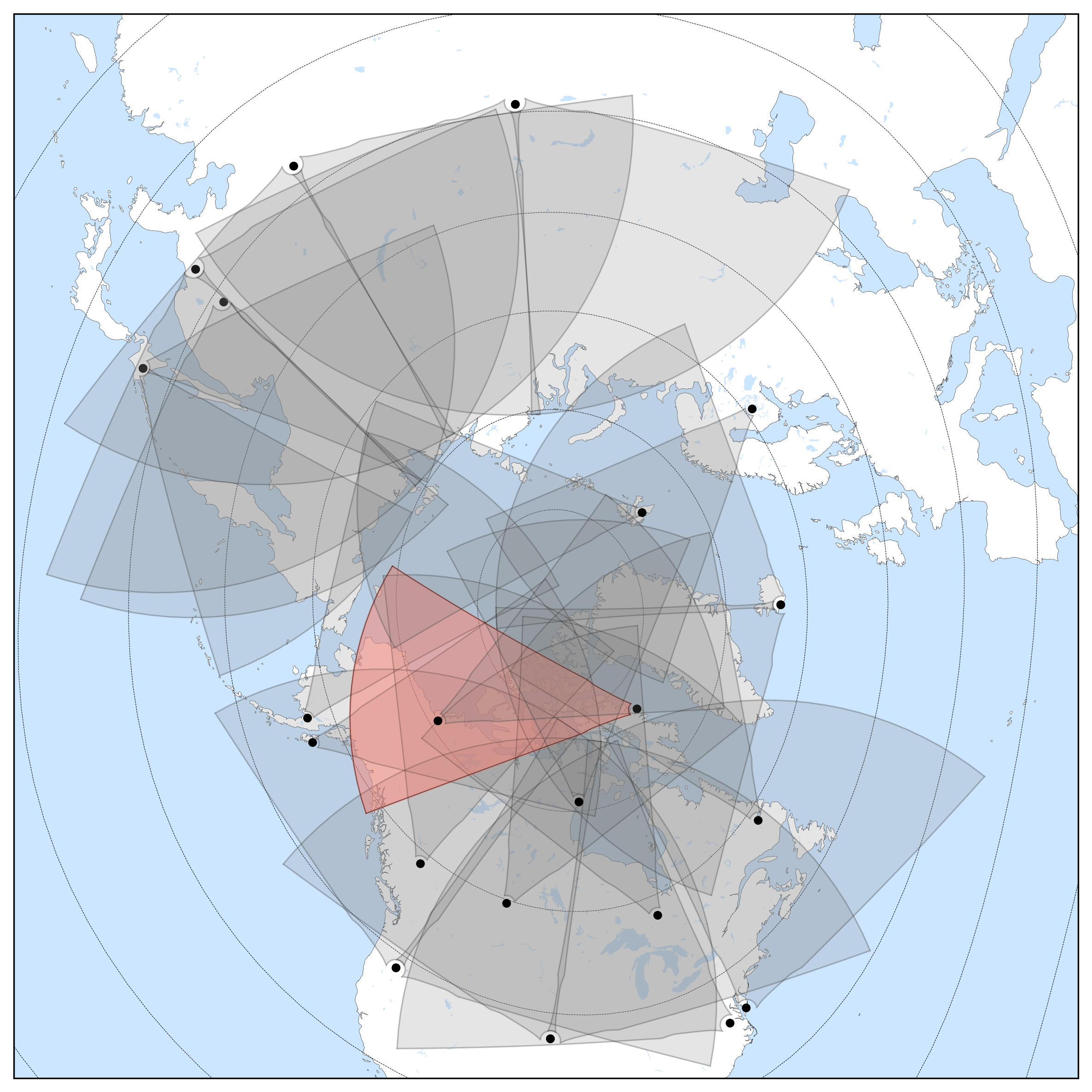
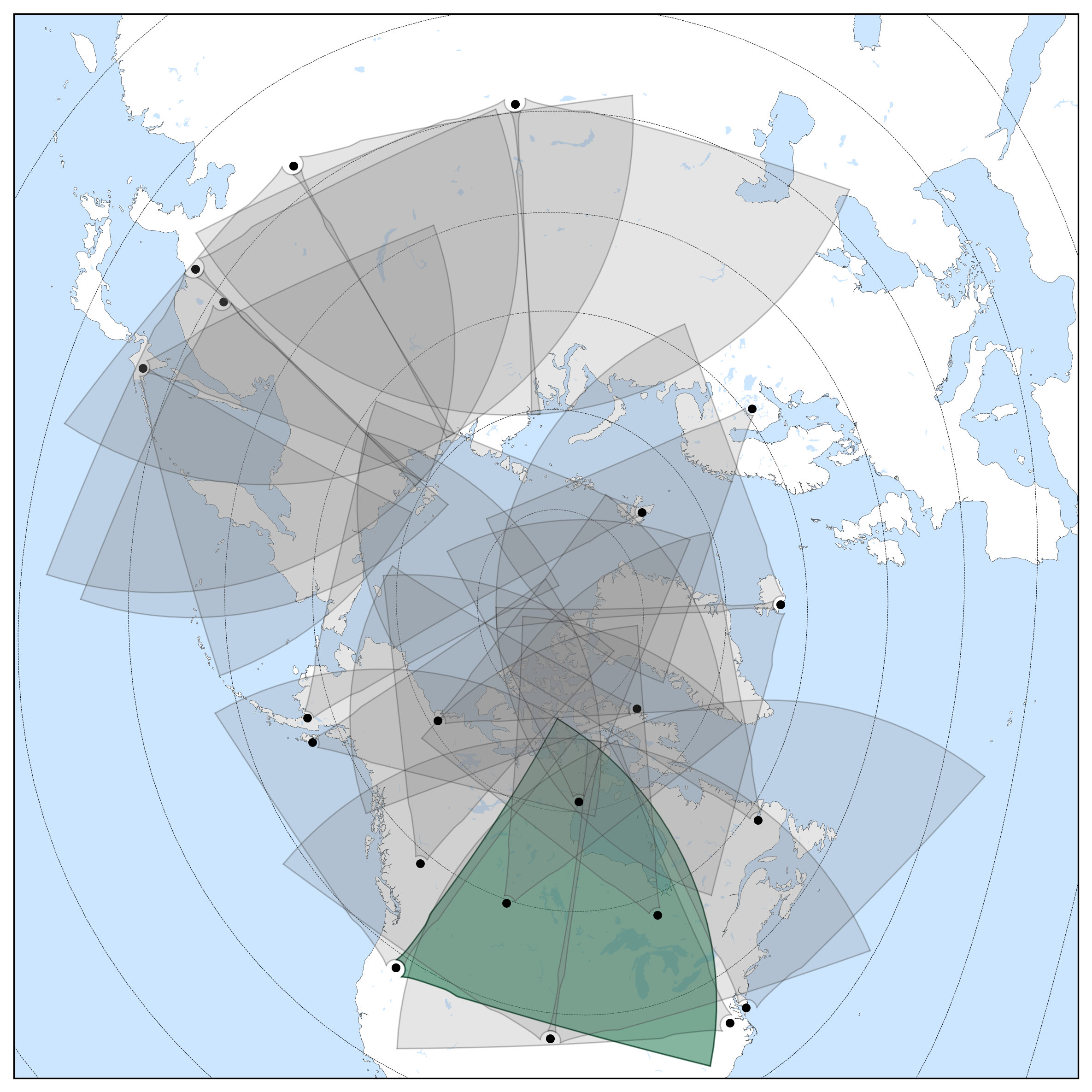
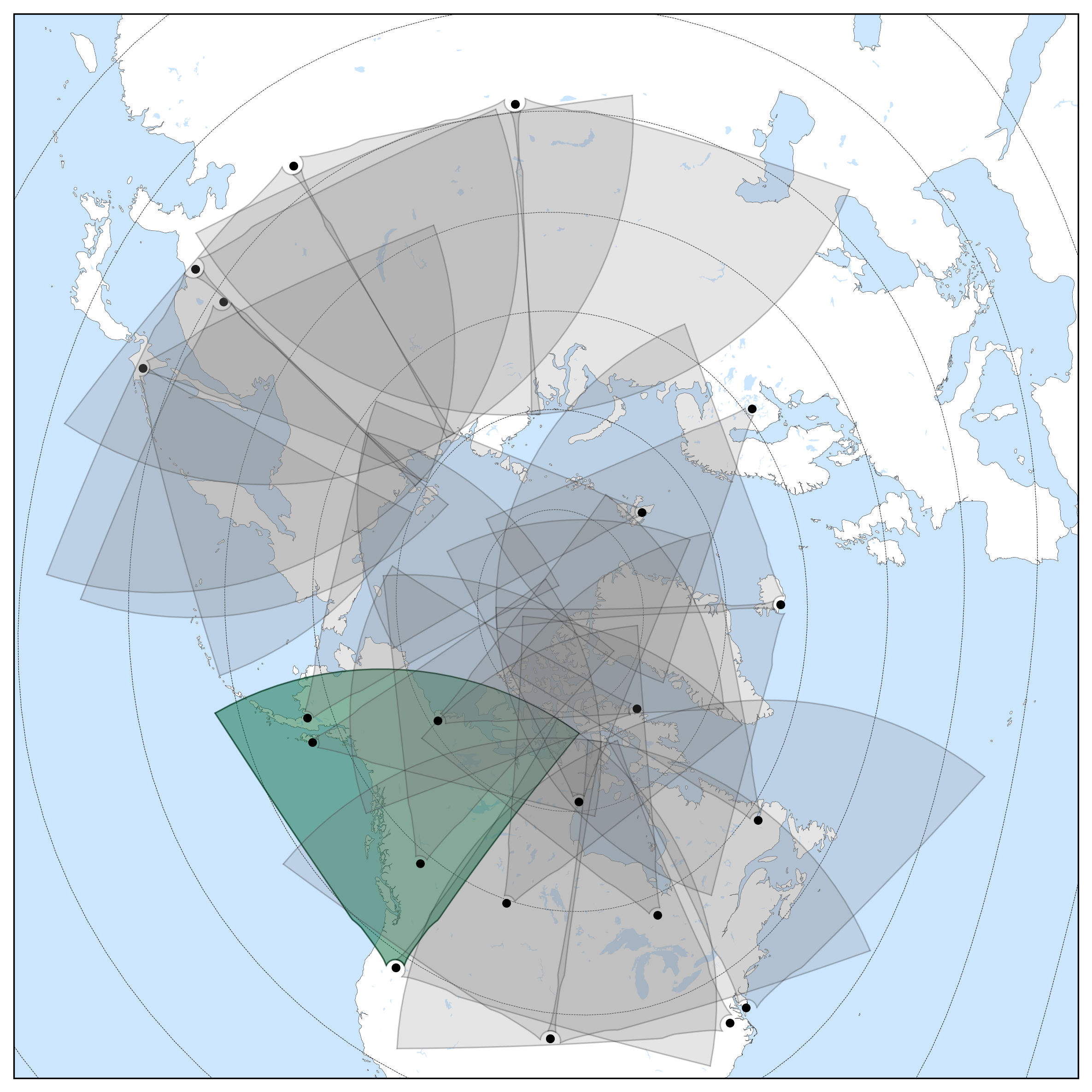
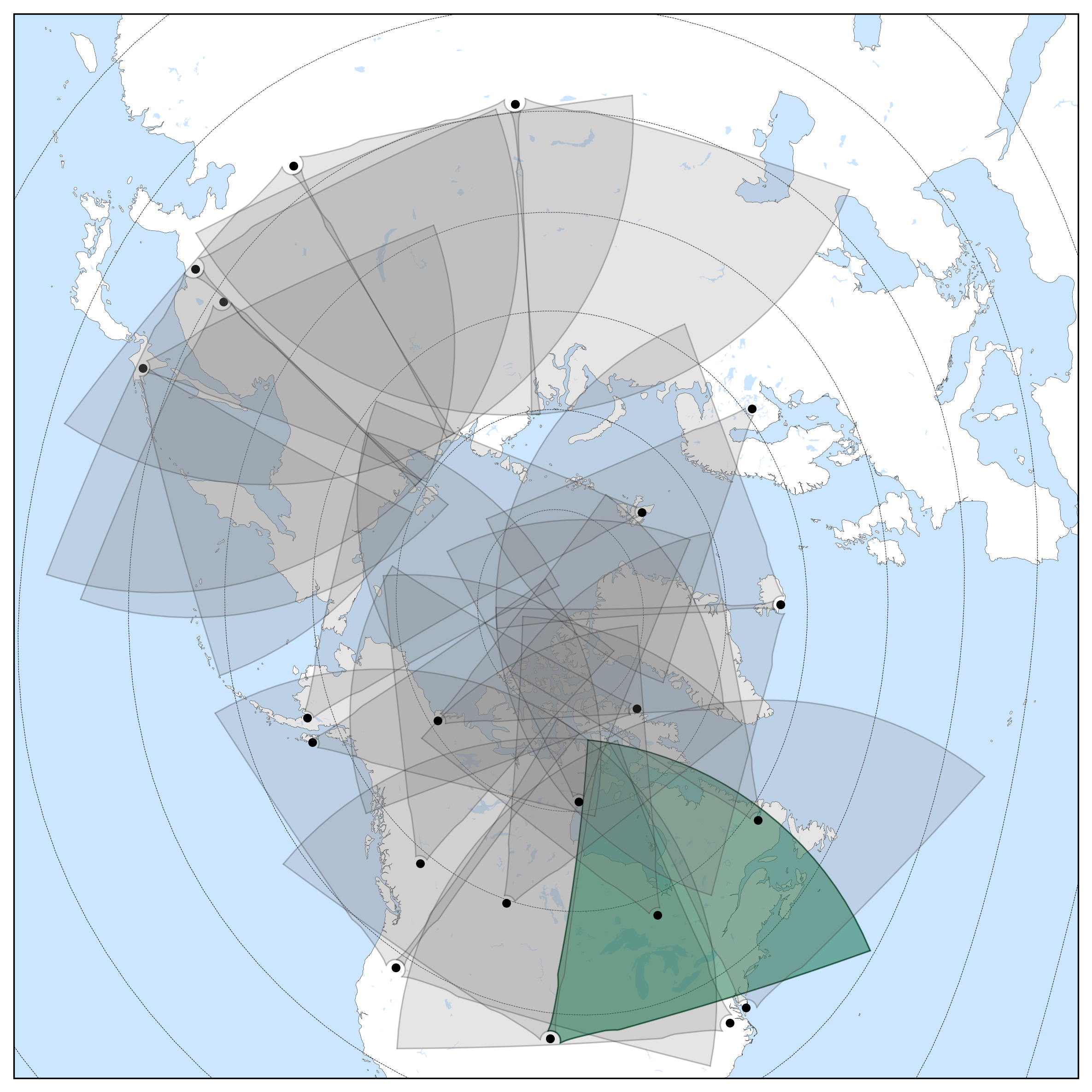
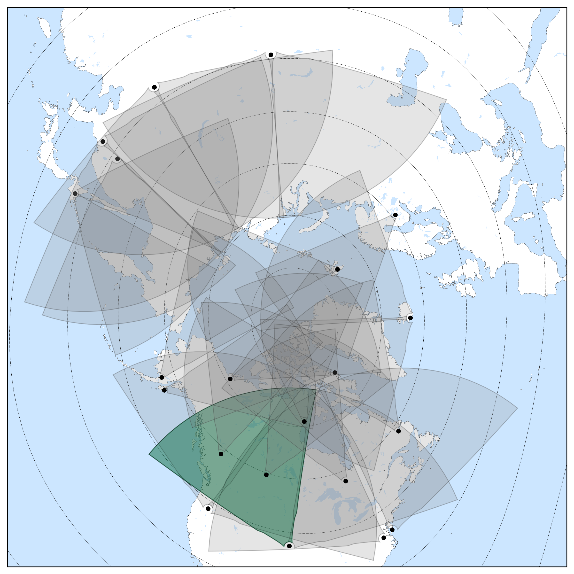
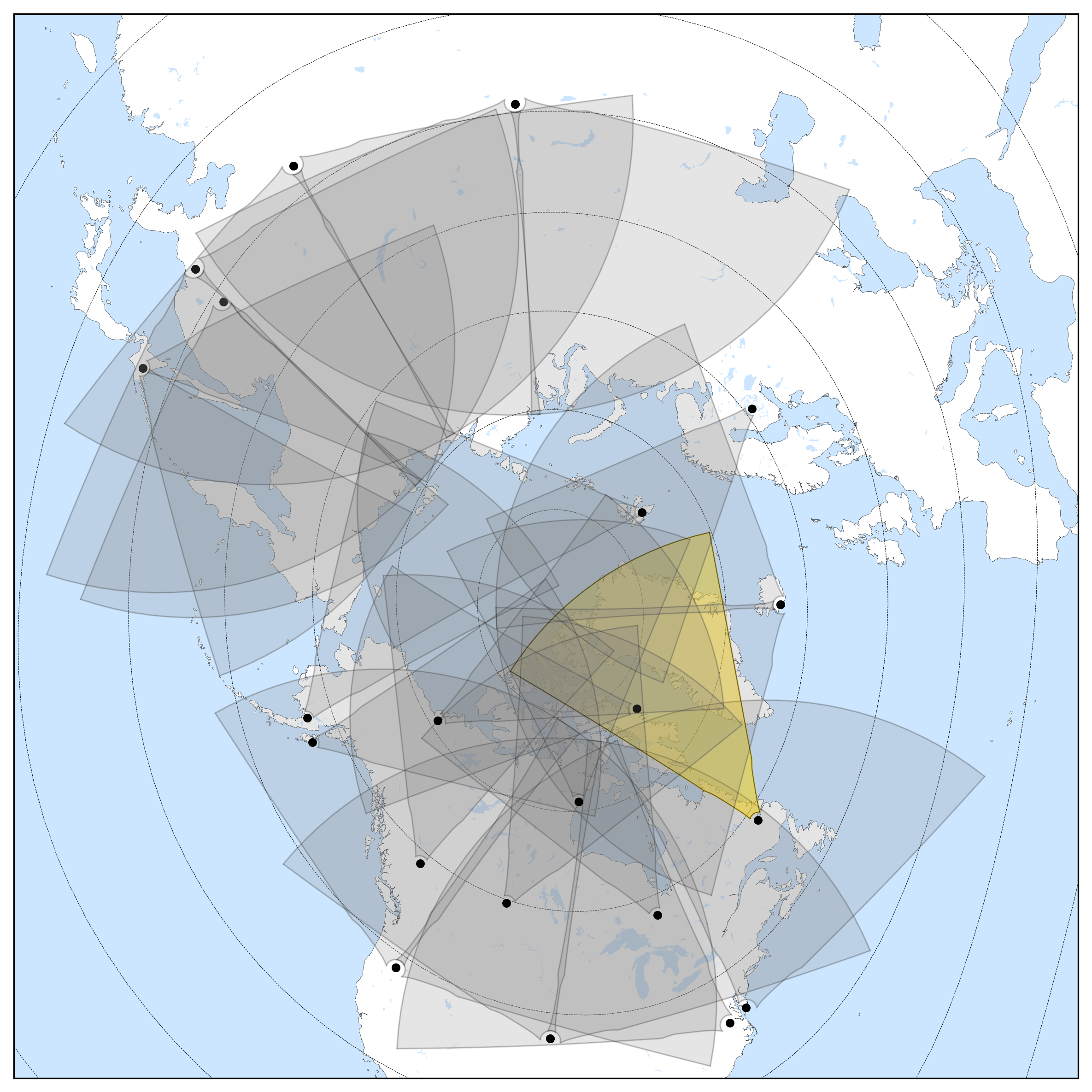
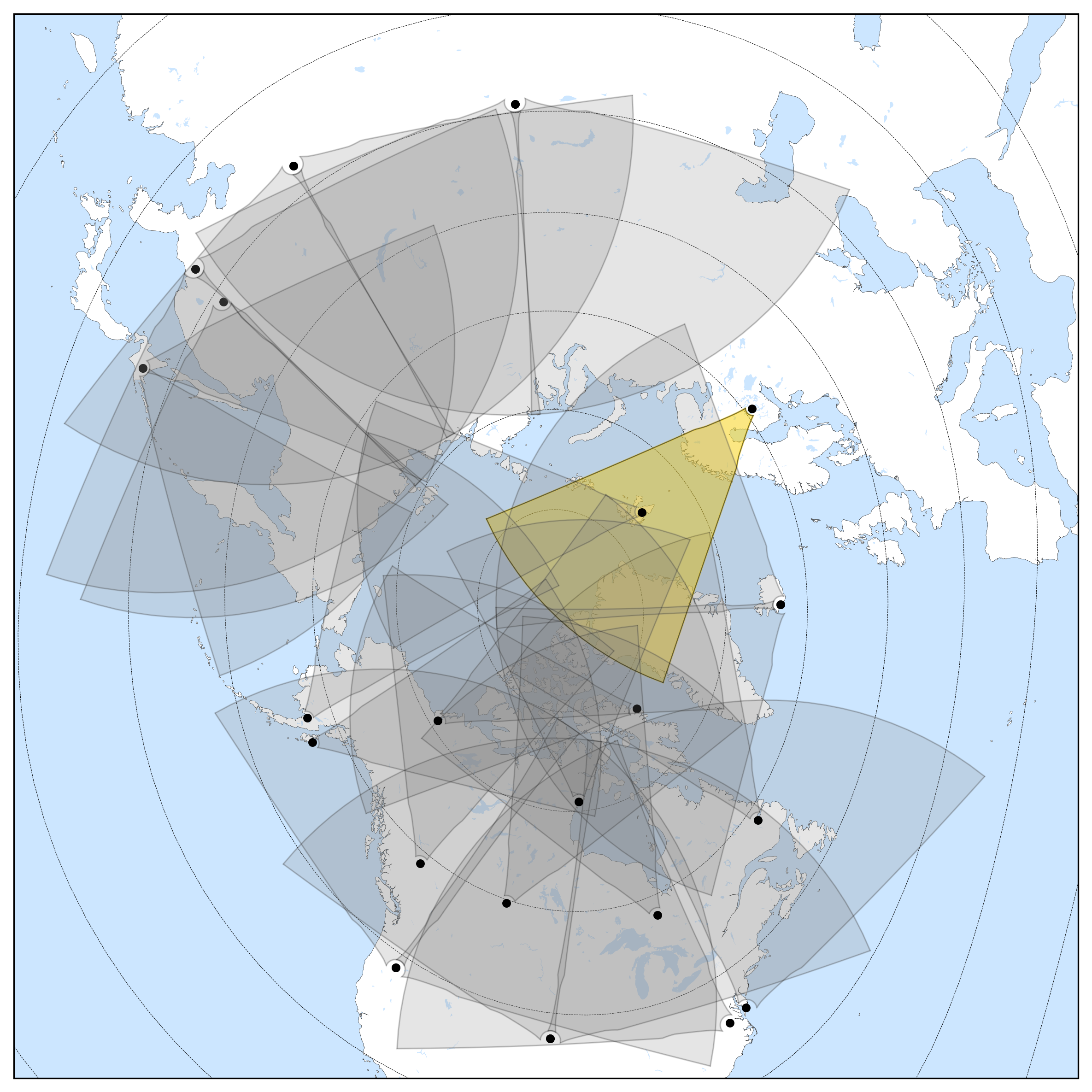
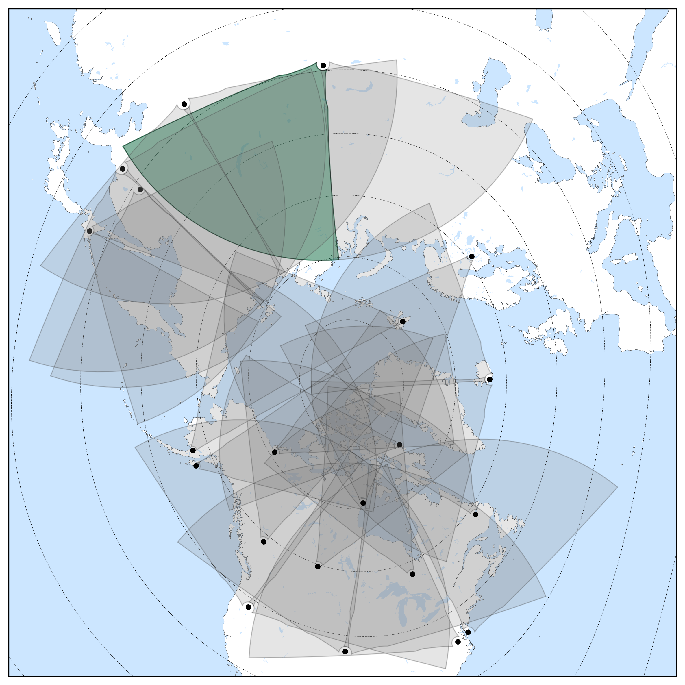
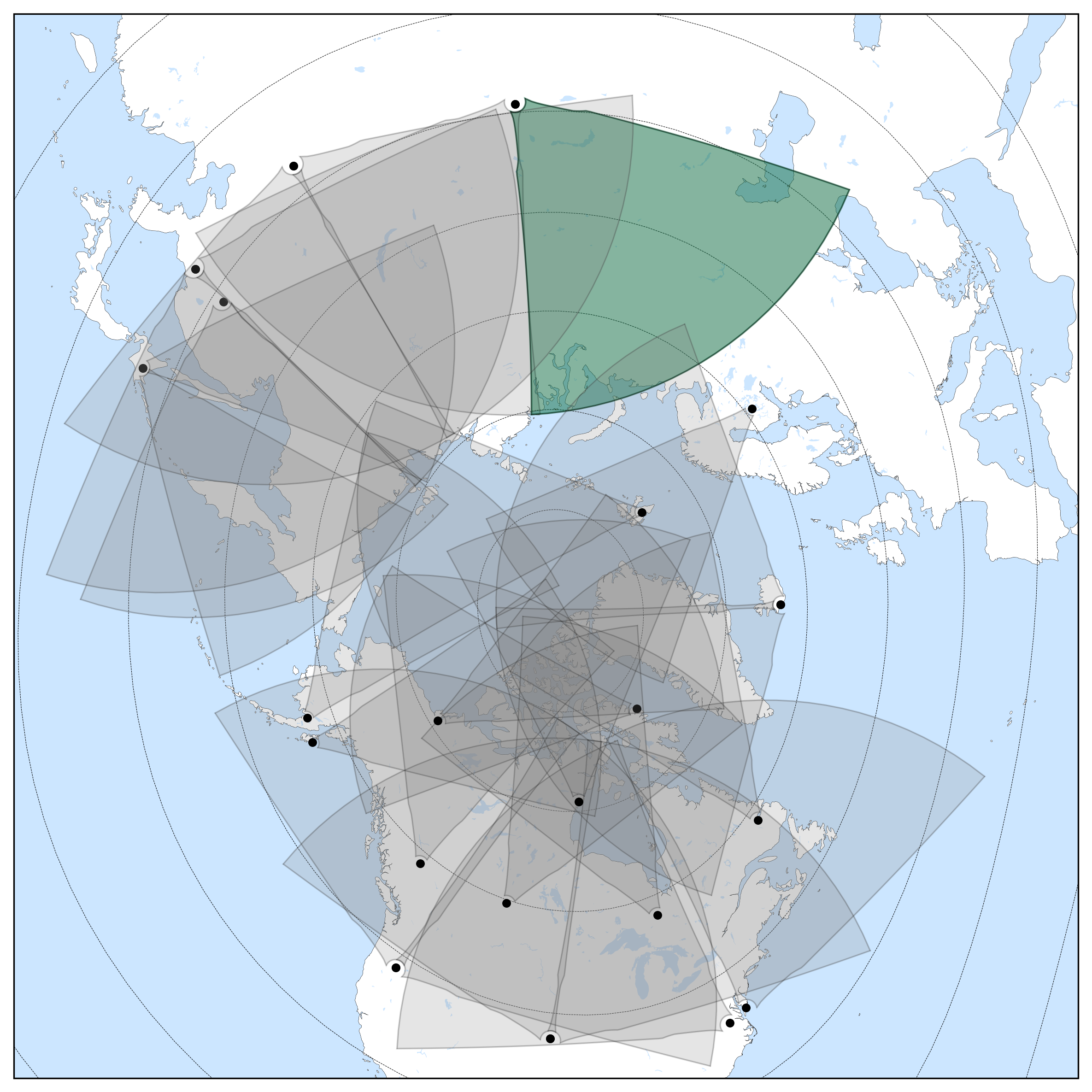
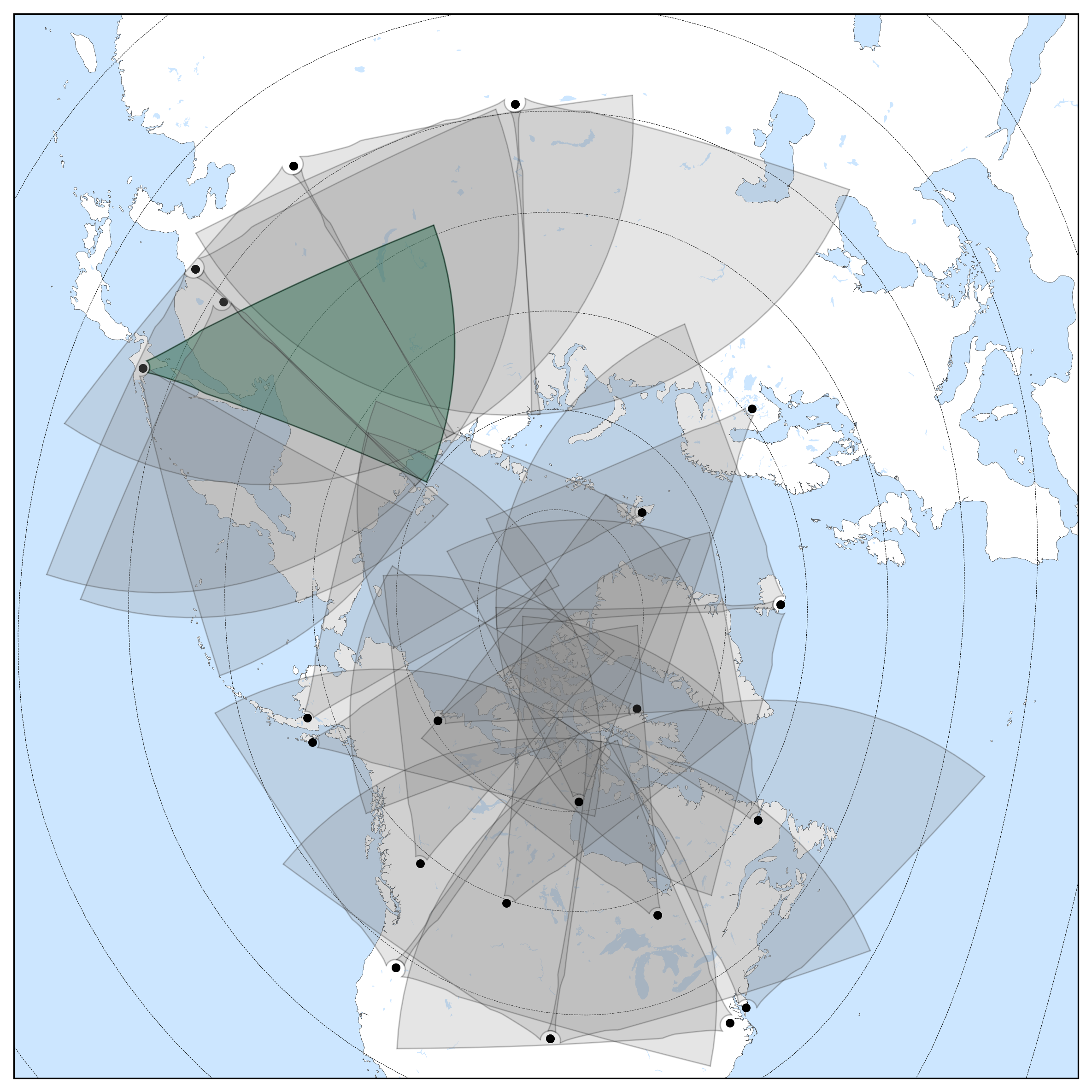
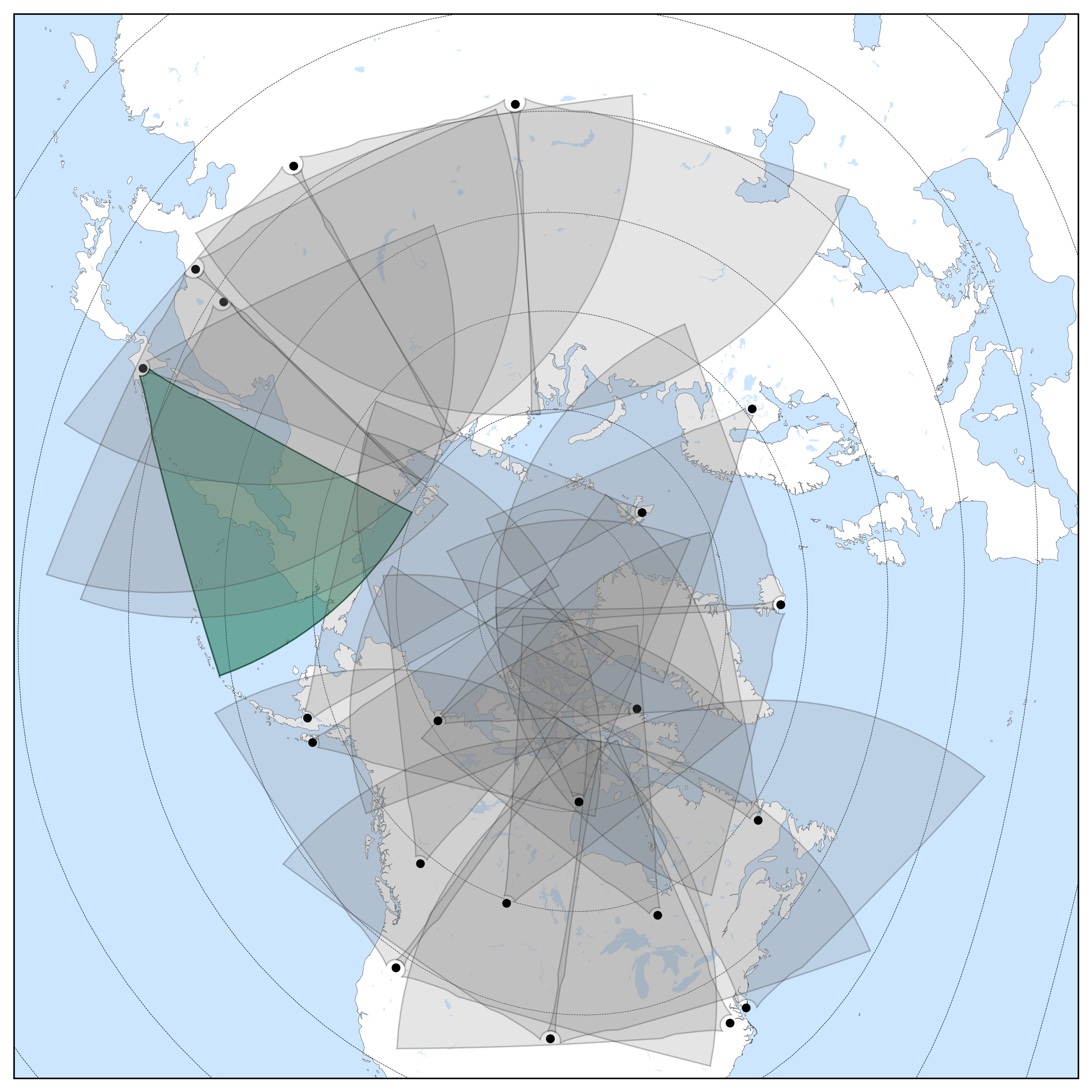
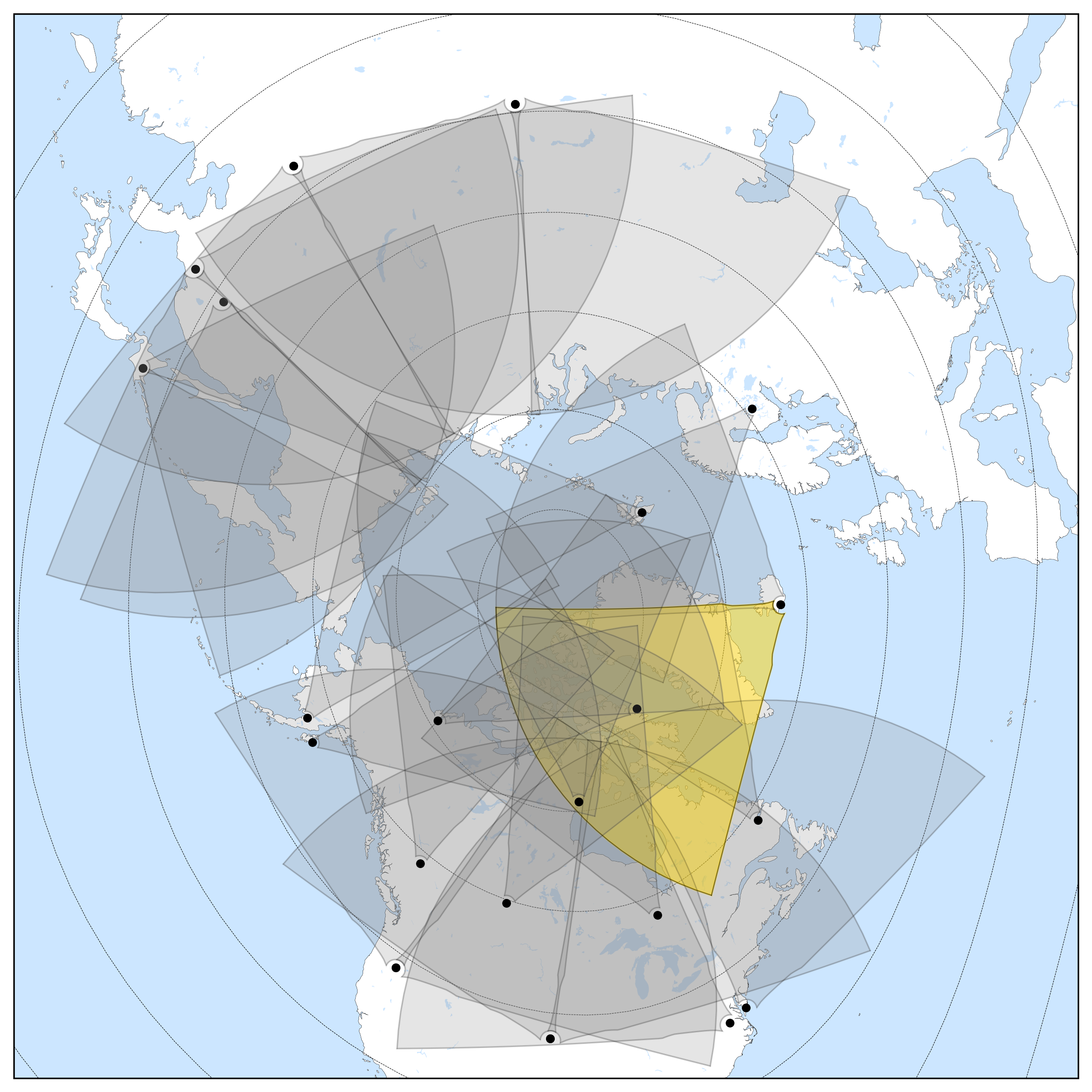
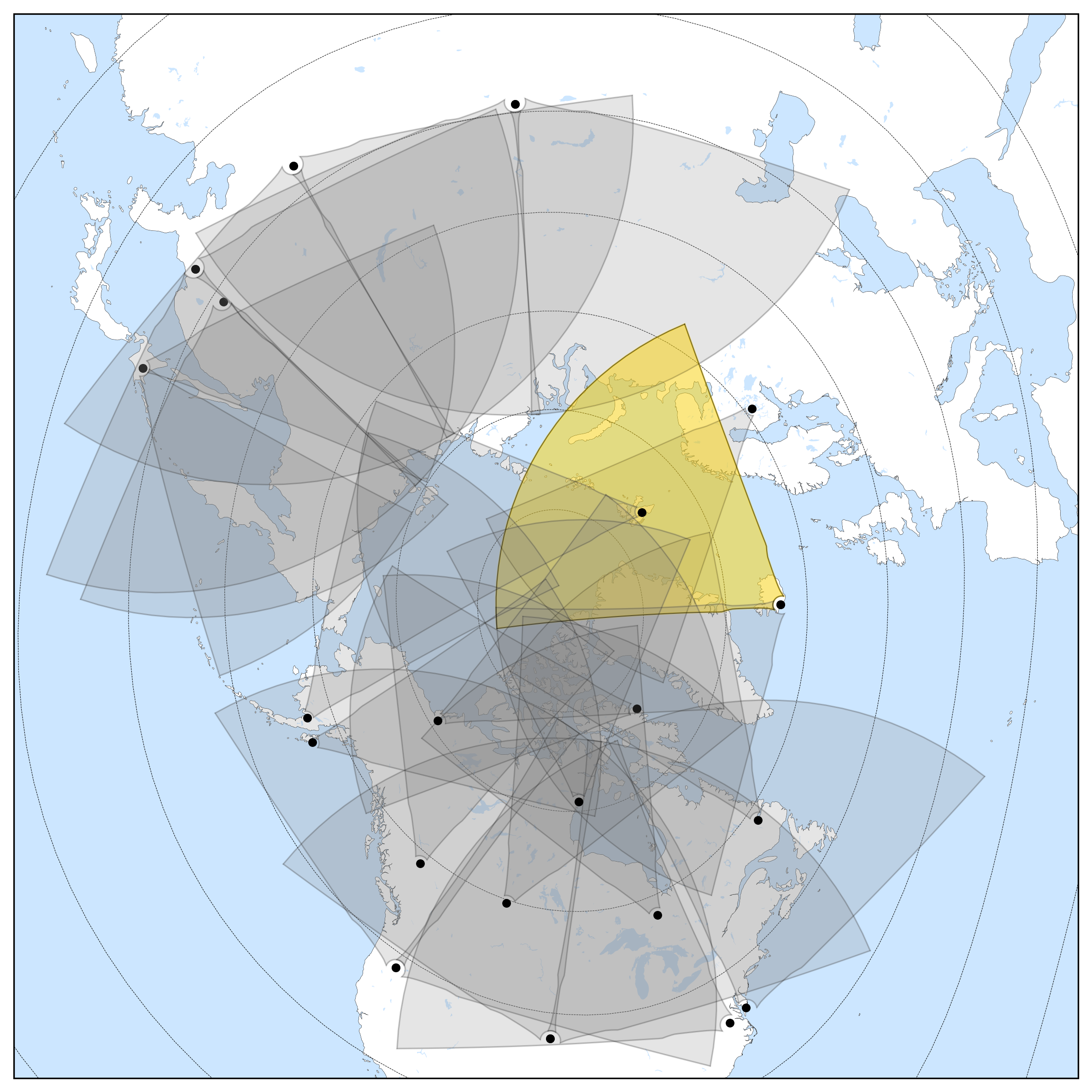
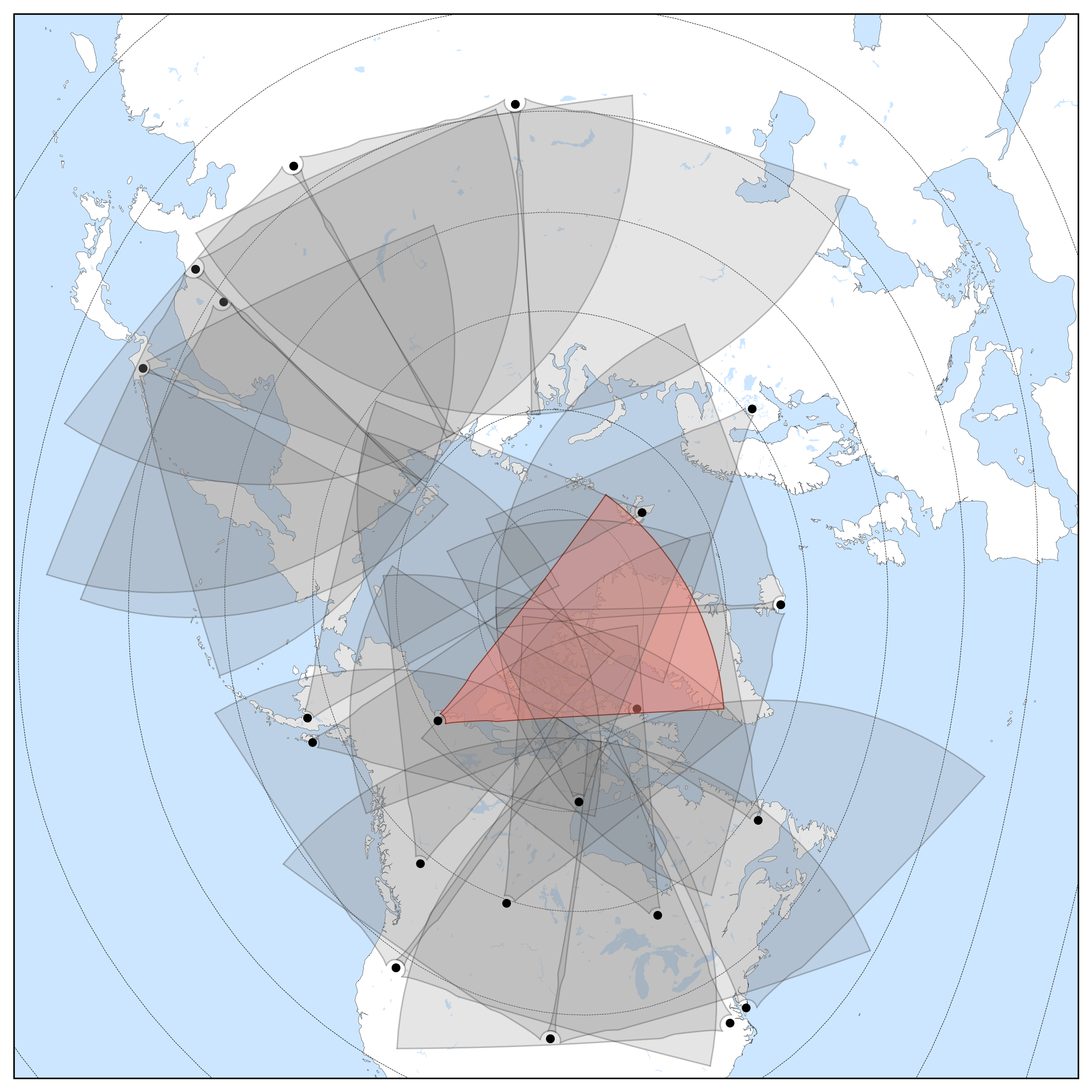
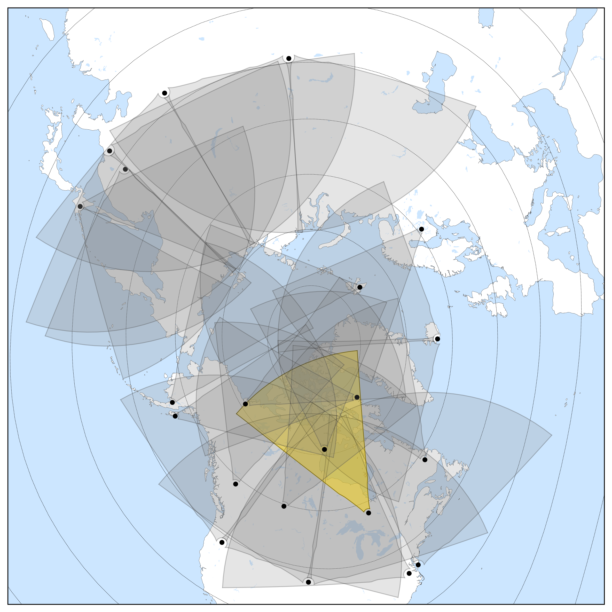
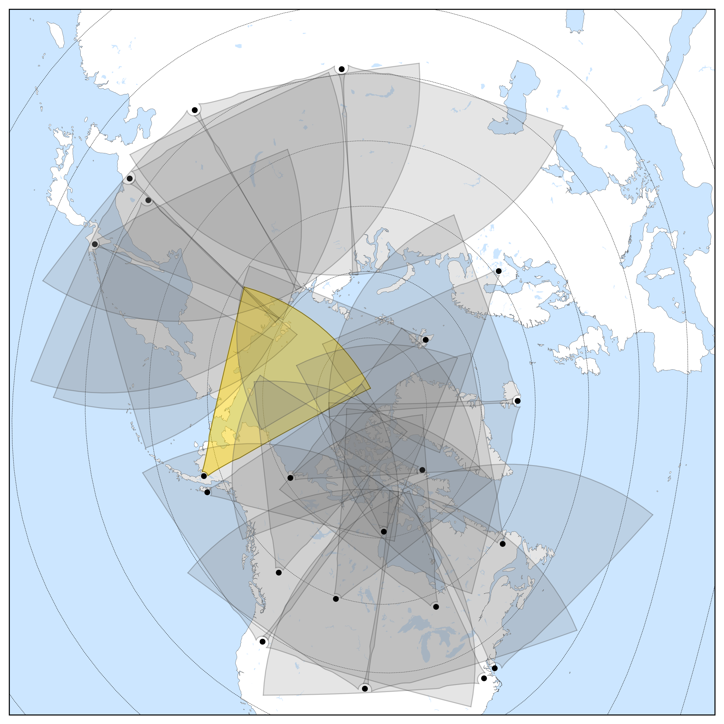
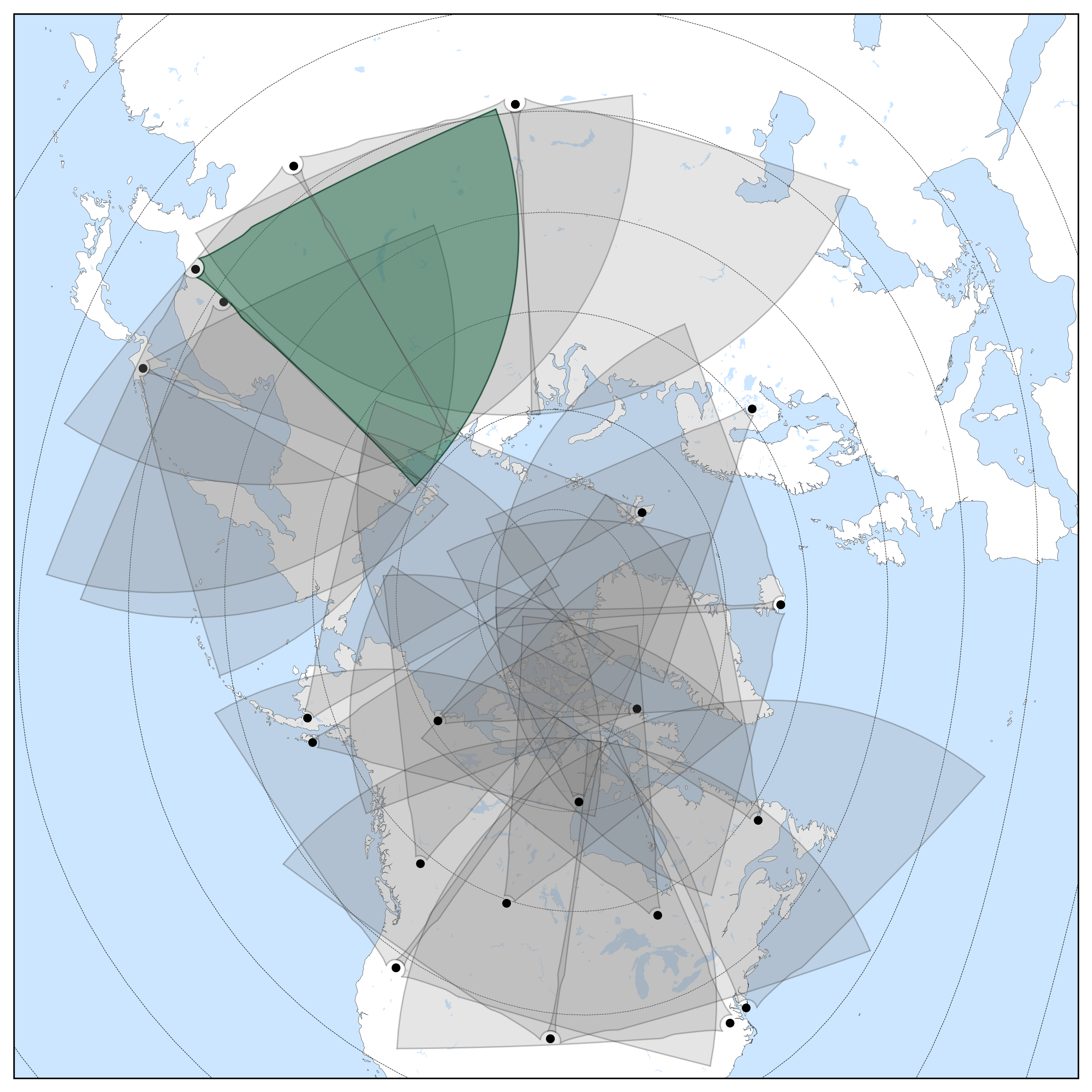
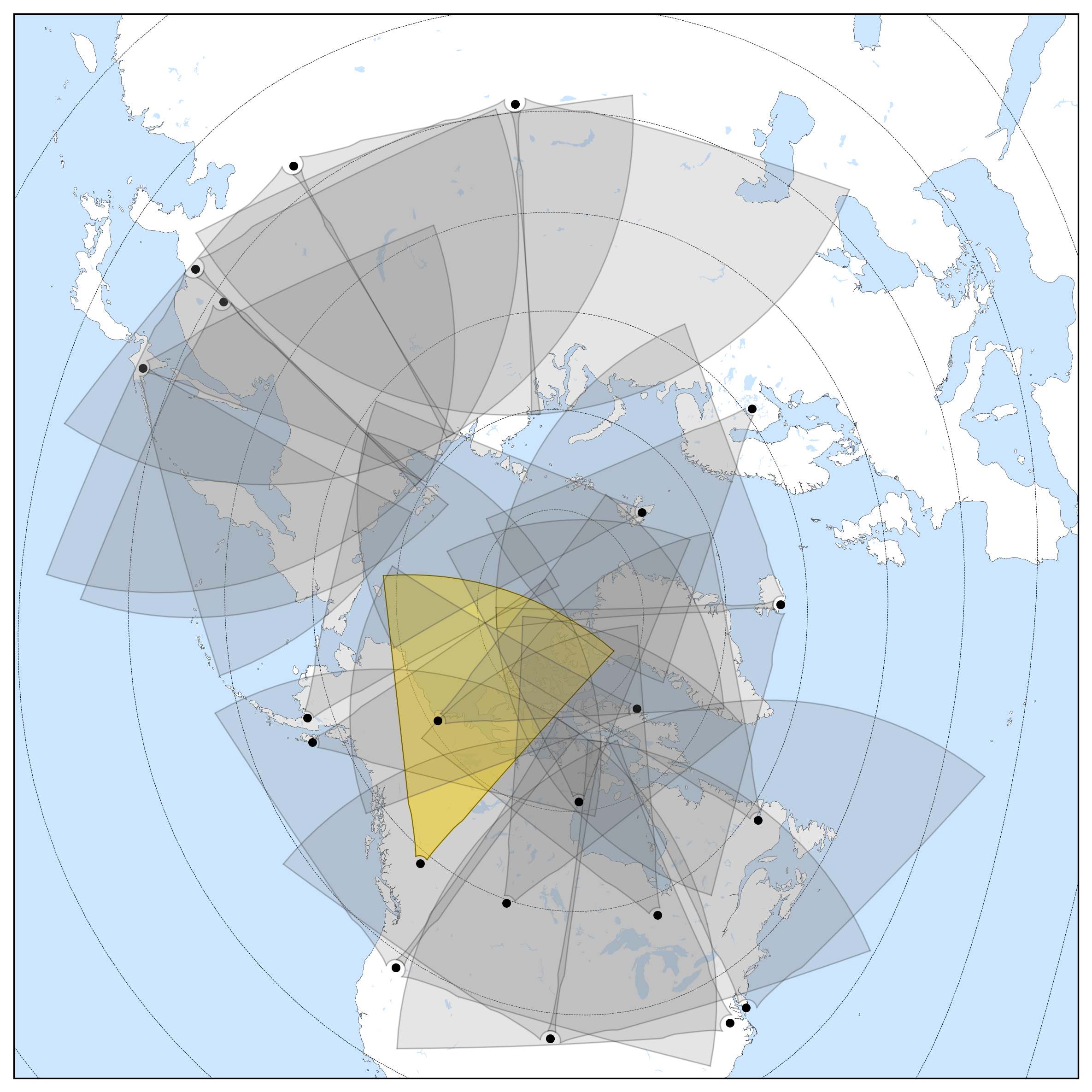
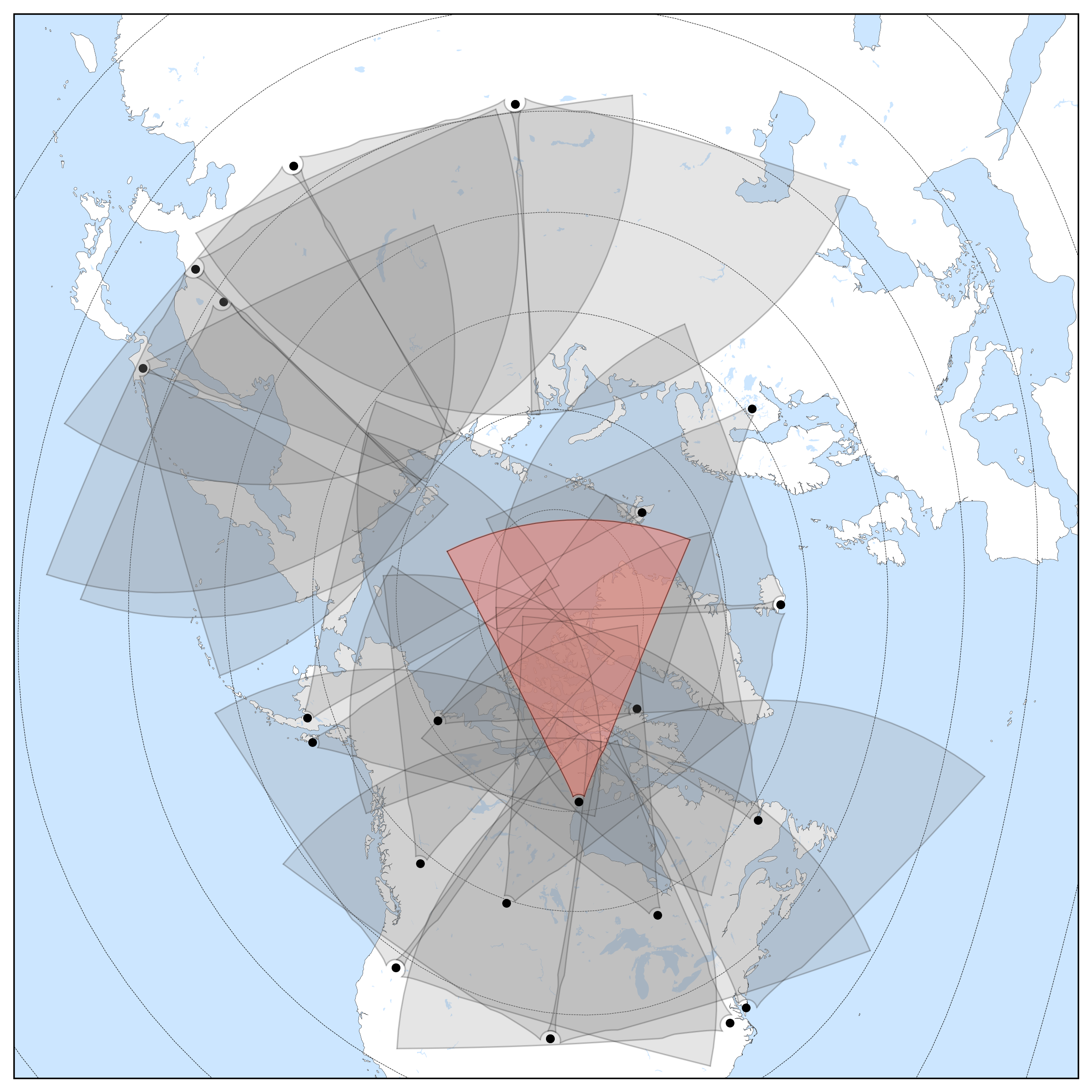
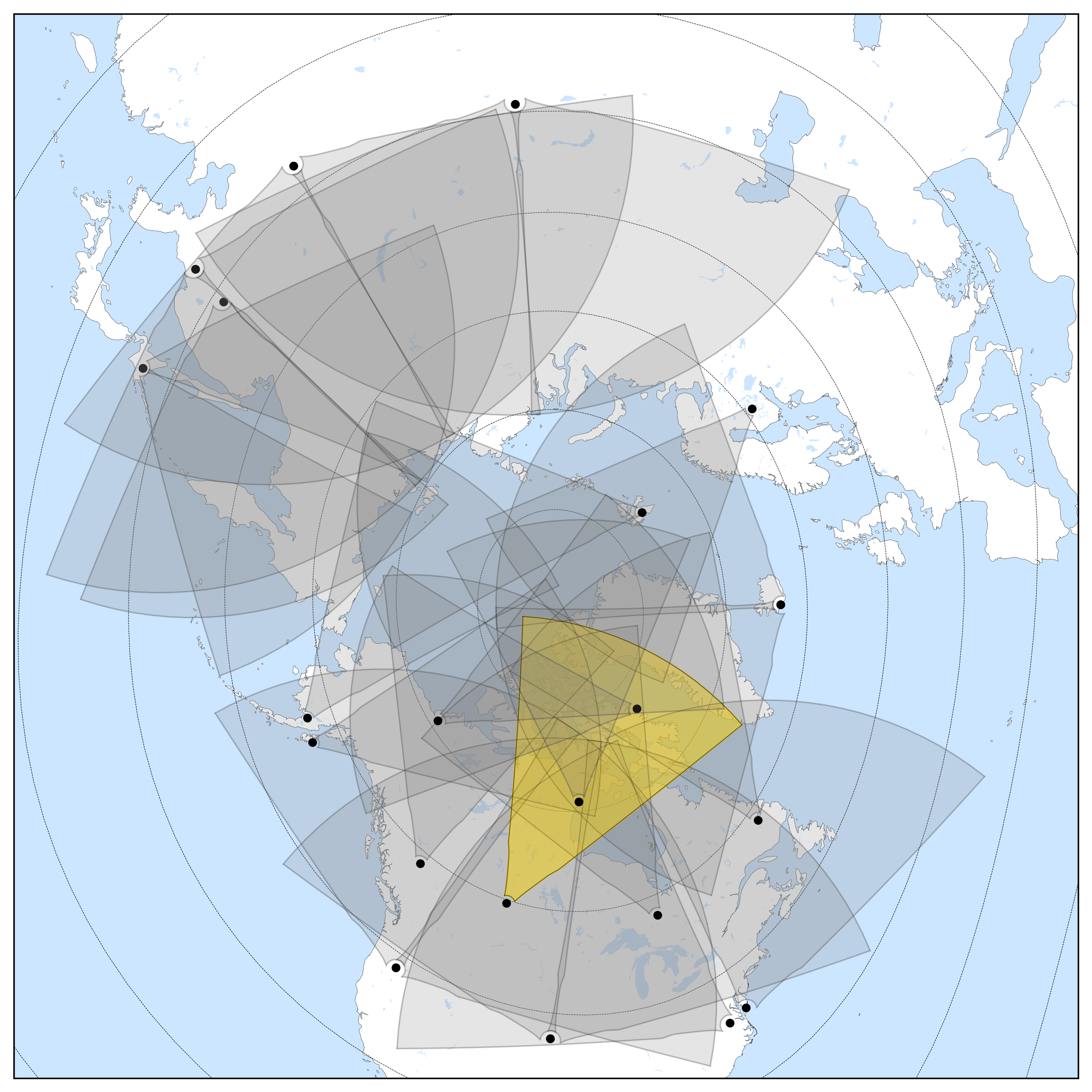
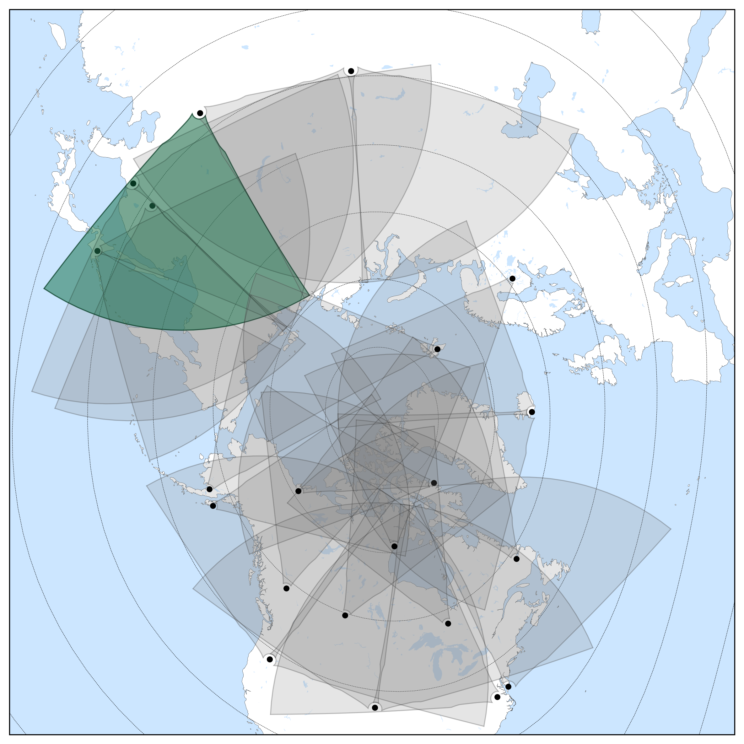
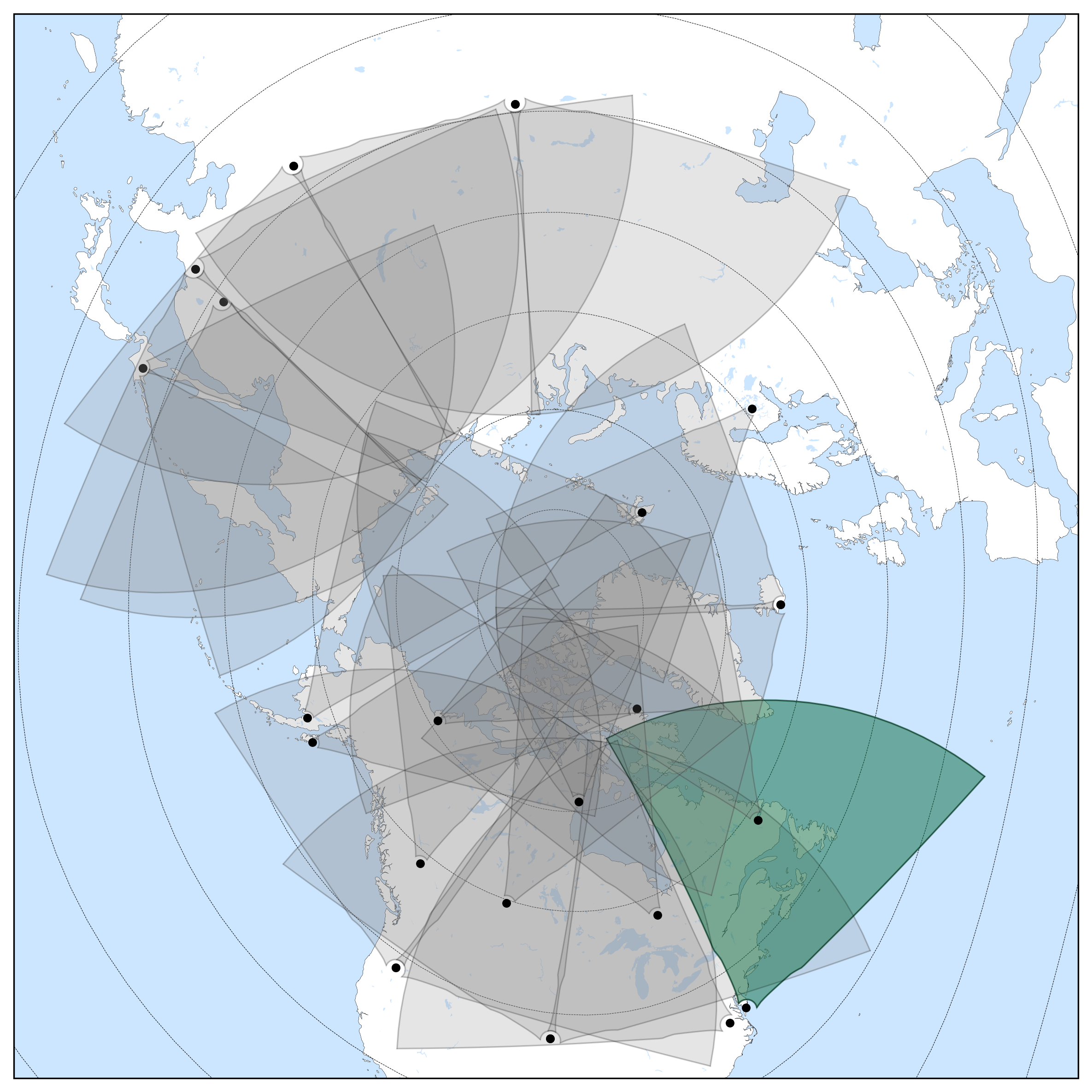
Northern Hemisphere Coverage
Southern Hemisphere Coverage
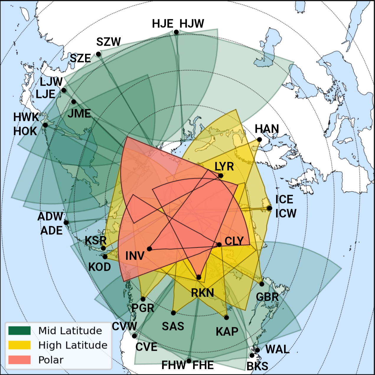
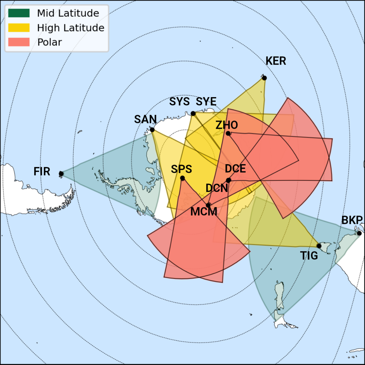
The above diagrams show field of view in grey for each radar in the Northern (left) and Southern (right) hemispheres. Both diagrams are viewing Earth from above the corresponding geographic pole, where the concentric ovals are showing the geomagnetic latitude. Each black dot is a radar station, labeled by its unique 3 letter code. The landmasses are shown in white.
Northern Hemisphere Radars
| Code | Station ID | Radar, Country Located | PI | Institution, Country | ||||||||||||||||||||||||||||||||||||||
|---|---|---|---|---|---|---|---|---|---|---|---|---|---|---|---|---|---|---|---|---|---|---|---|---|---|---|---|---|---|---|---|---|---|---|---|---|---|---|---|---|---|---|
| ade | 209 | Adak Island East  |
Dr. Bill Bristow | Penn State University  |
||||||||||||||||||||||||||||||||||||||
Adak Island East
General Radar Info
Current Technical Info
|
||||||||||||||||||||||||||||||||||||||||||
| adw | 208 | Adak Island West |
Dr. Bill Bristow | Penn State University |
||||||||||||||||||||||||||||||||||||||
Adak Island West

General Radar Info
Current Technical Info
|
||||||||||||||||||||||||||||||||||||||||||
| bks | 33 | Blackstone |
Dr. J. Michael Ruohoniemi | Virginia Tech |
||||||||||||||||||||||||||||||||||||||
Blackstone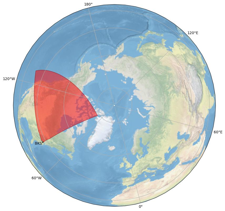
General Radar Info
Current Technical Info
|
||||||||||||||||||||||||||||||||||||||||||
| cly | 66 | Clyde River  |
Dr. Glenn Hussey | University of Saskatchewan  |
||||||||||||||||||||||||||||||||||||||
Clyde River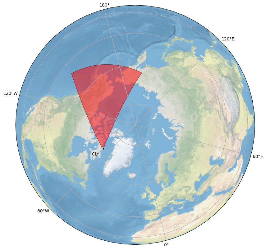
General Radar Info
Current Technical Info
|
||||||||||||||||||||||||||||||||||||||||||
| cve | 207 | Christmas Valley East |
Dr. Simon Shepherd | Dartmouth College |
||||||||||||||||||||||||||||||||||||||
Christmas Valley East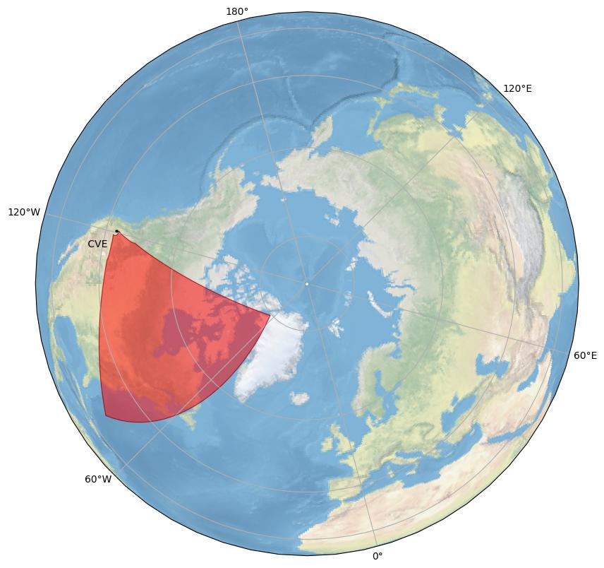
General Radar Info
Current Technical Info
|
||||||||||||||||||||||||||||||||||||||||||
| cvw | 206 | Christmas Valley West |
Dr. Simon Shepherd | Dartmouth College |
||||||||||||||||||||||||||||||||||||||
Christmas Valley West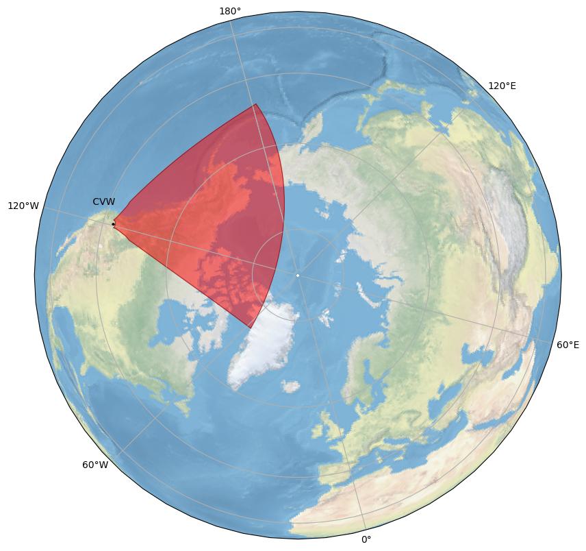
General Radar Info
Current Technical Info
|
||||||||||||||||||||||||||||||||||||||||||
| fhe | 205 | Fort Hays East |
Dr. J. Michael Ruohoniemi | Virginia Tech |
||||||||||||||||||||||||||||||||||||||
Fort Hays East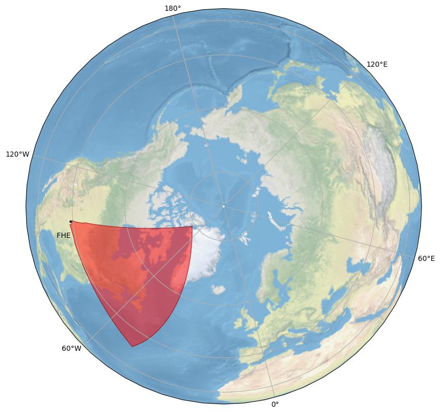
General Radar Info
Current Technical Info
|
||||||||||||||||||||||||||||||||||||||||||
| fhw | 204 | Fort Hays West |
Dr. J. Michael Ruohoniemi | Virginia Tech |
||||||||||||||||||||||||||||||||||||||
Fort Hays West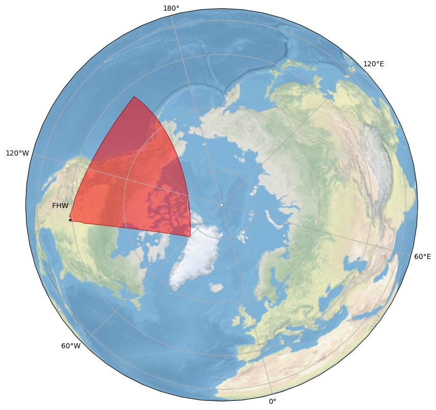
General Radar Info
Current Technical Info
|
||||||||||||||||||||||||||||||||||||||||||
| gbr | g | 1 | Goose Bay |
Dr. J. Michael Ruohoniemi | Virginia Tech |
|||||||||||||||||||||||||||||||||||||
Goose Bay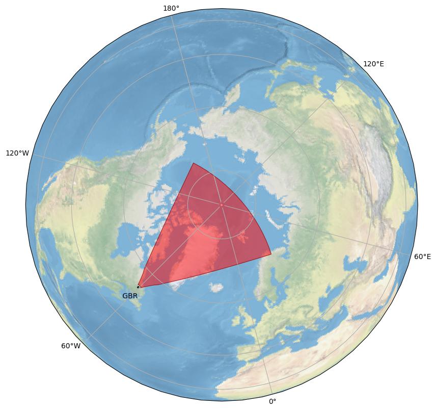
General Radar Info
Current Technical Info
|
||||||||||||||||||||||||||||||||||||||||||
| han | f | 10 | Hankasalmi  |
Dr. Tim Yeoman | University of Leicester  |
|||||||||||||||||||||||||||||||||||||
Hankasalmi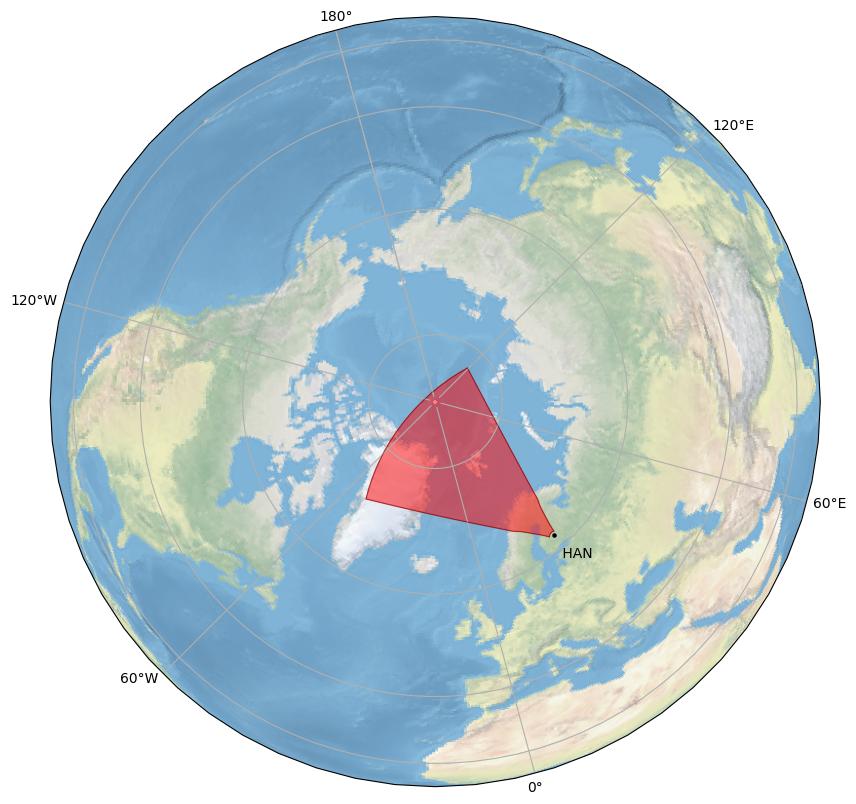
General Radar Info
Current Technical Info
|
||||||||||||||||||||||||||||||||||||||||||
| hje | 55 | Hejing East  |
Dr. J.J. Zhang | Chinese Academy of Sciences  |
||||||||||||||||||||||||||||||||||||||
Hejing East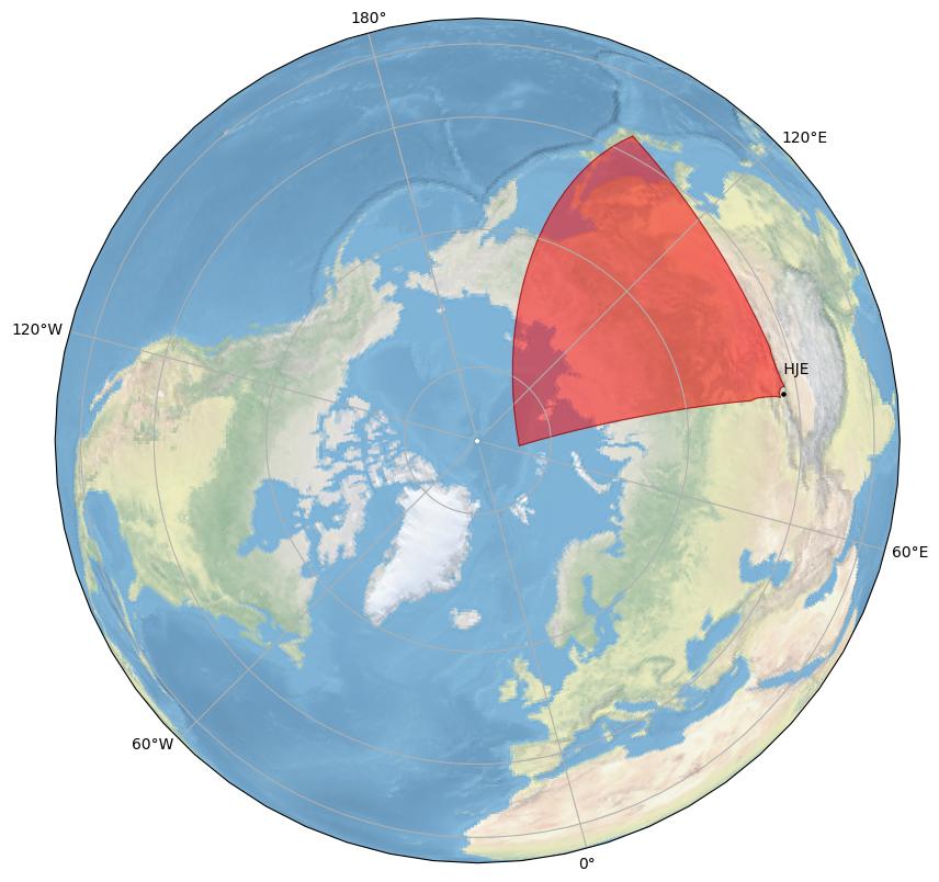
General Radar Info
Current Technical Info
|
||||||||||||||||||||||||||||||||||||||||||
| hjw | 56 | Hejing West |
Dr. J.J. Zhang | Chinese Academy of Sciences |
||||||||||||||||||||||||||||||||||||||
Hejing West
General Radar Info
Current Technical Info
|
||||||||||||||||||||||||||||||||||||||||||
| hkw | 41 | Hokkaido West  |
Dr. Nozomu Nishitani | Nagoya University  |
||||||||||||||||||||||||||||||||||||||
Hokkaido West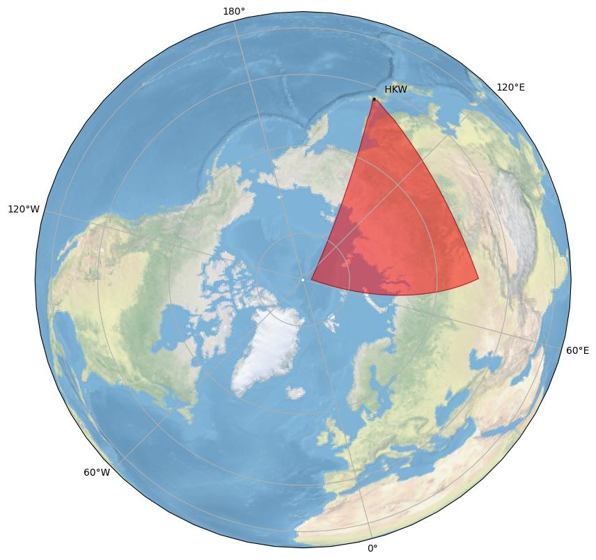
General Radar Info
Current Technical Info
|
||||||||||||||||||||||||||||||||||||||||||
| hok | 40 | Hokkaido East |
Dr. Nozomu Nishitani | Nagoya University |
||||||||||||||||||||||||||||||||||||||
Hokkaido East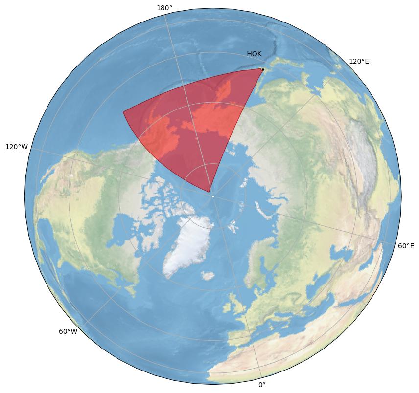
General Radar Info
Current Technical Info
|
||||||||||||||||||||||||||||||||||||||||||
| ice | 211 | Iceland East  |
Dr. Simon Shepherd | Dartmouth College |
||||||||||||||||||||||||||||||||||||||
Iceland East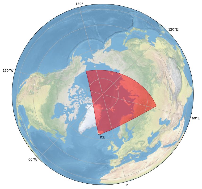
General Radar Info
Current Technical Info
|
||||||||||||||||||||||||||||||||||||||||||
| icw | 210 | Iceland West |
Dr. Simon Shepherd | Dartmouth College |
||||||||||||||||||||||||||||||||||||||
Iceland West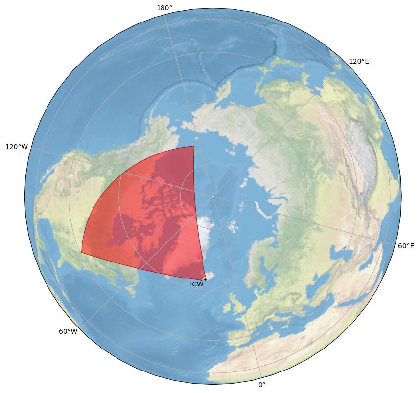
General Radar Info
Current Technical Info
|
||||||||||||||||||||||||||||||||||||||||||
| inv | 64 | Inuvik |
Dr. Glenn Hussey | University of Saskatchewan |
||||||||||||||||||||||||||||||||||||||
Inuvik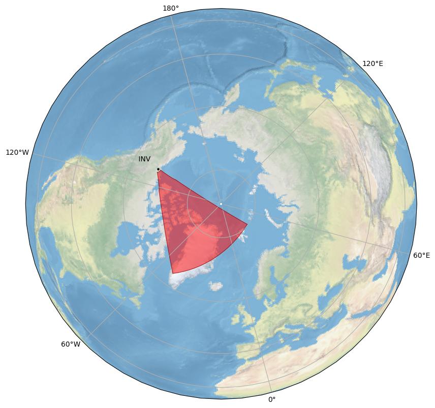
General Radar Info
Current Technical Info
|
||||||||||||||||||||||||||||||||||||||||||
| jme | 50 | Jiamusi East |
Dr. J.J. Zhang | Chinese Academy of Sciences |
||||||||||||||||||||||||||||||||||||||
Jiamusi East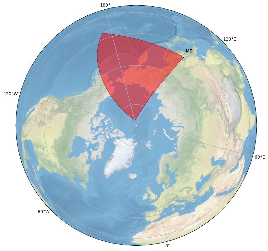
General Radar Info
Current Technical Info
|
||||||||||||||||||||||||||||||||||||||||||
| kap | k | 3 | Kapuskasing |
Dr. J. Michael Ruohoniemi | Virginia Tech |
|||||||||||||||||||||||||||||||||||||
Kapuskasing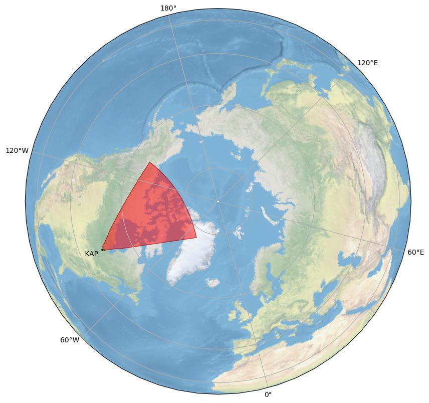
General Radar Info
Current Technical Info
|
||||||||||||||||||||||||||||||||||||||||||
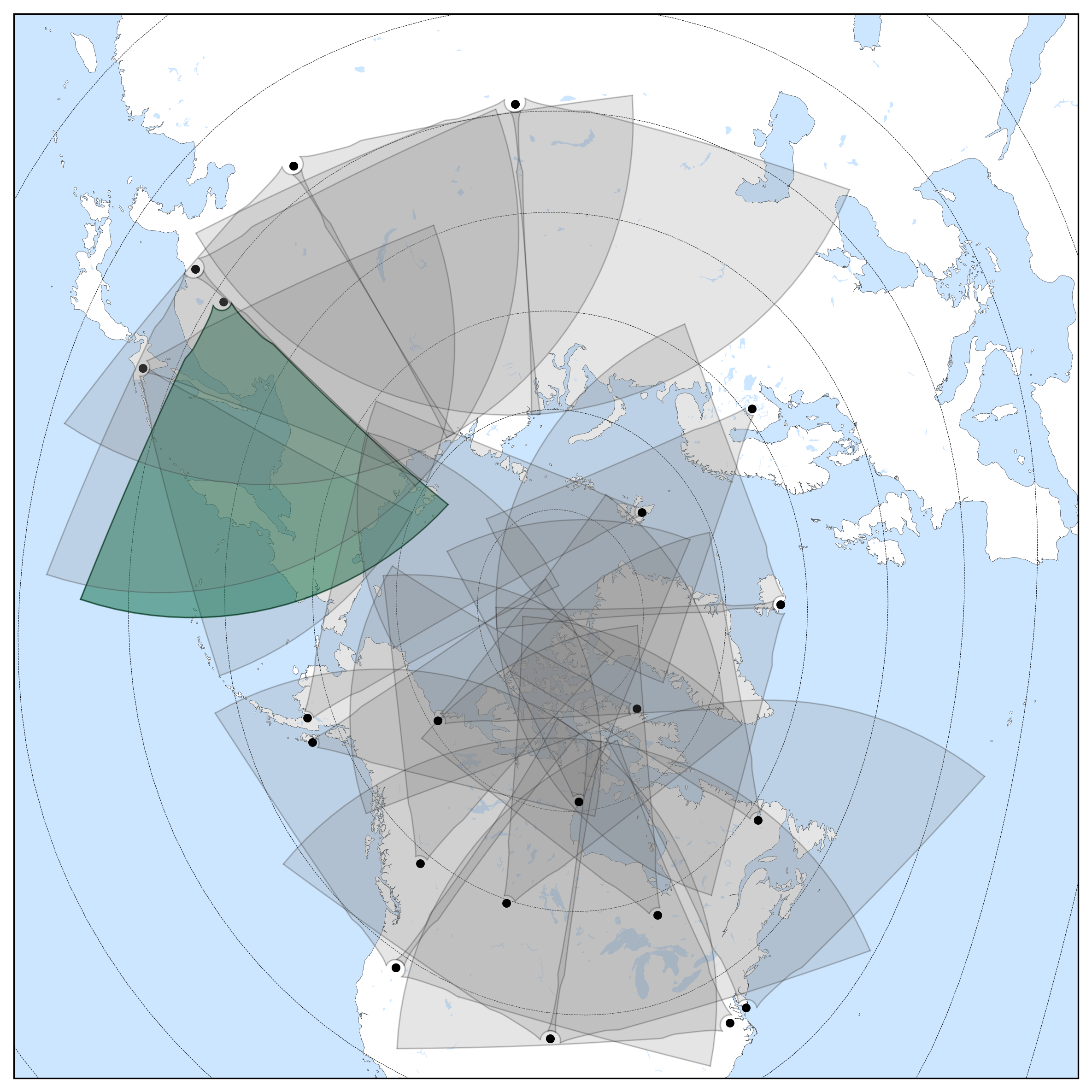
| kod | a | 7 | Kodiak |
Dr. Bill Bristow | Penn State University |
|||||||||||||||||||||||||||||||||||||
Kodiak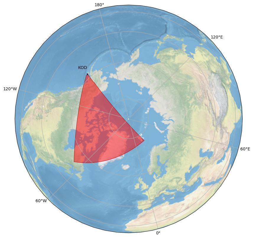
General Radar Info
Current Technical Info
|
||||||||||||||||||||||||||||||||||||||||||
| ksr | c | 16 | King Salmon |
Dr. Bill Bristow | Penn State University |
|||||||||||||||||||||||||||||||||||||
King Salmon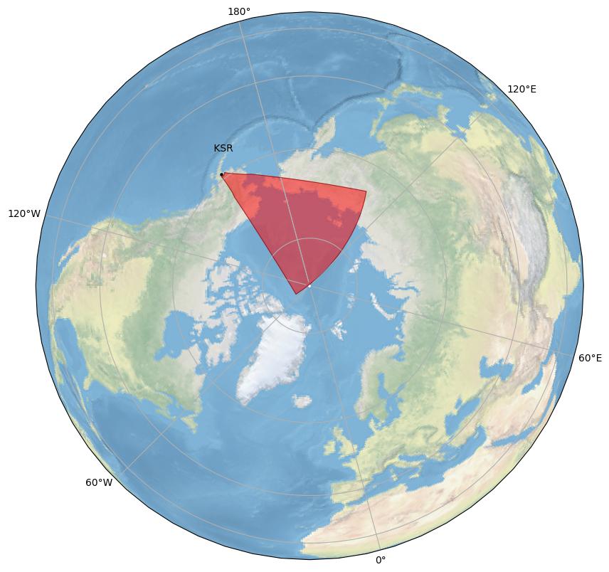
General Radar Info
Current Technical Info
|
||||||||||||||||||||||||||||||||||||||||||
| lje | 51 | Longjing East |
Dr. J.J. Zhang | Chinese Academy of Sciences |
||||||||||||||||||||||||||||||||||||||
Longjing East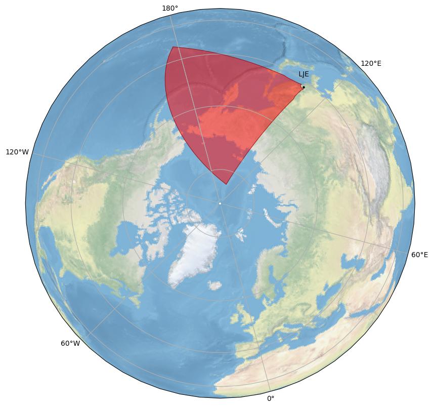
General Radar Info
Current Technical Info
|
||||||||||||||||||||||||||||||||||||||||||
| ljw | 52 | Longjing West |
Dr. J.J. Zhang | Chinese Academy of Sciences |
||||||||||||||||||||||||||||||||||||||
Longjing West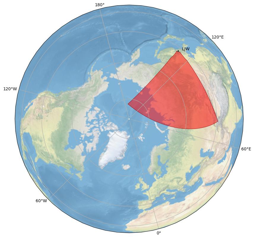
General Radar Info
Current Technical Info
|
||||||||||||||||||||||||||||||||||||||||||
| lyr | 90 | Longyearbyen  |
Dr. Dag Lorentzen | University Centre in Svalbard  |
||||||||||||||||||||||||||||||||||||||
Longyearbyen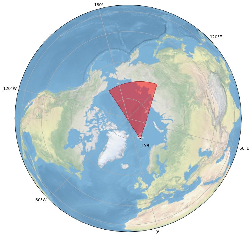
General Radar Info
Current Technical Info
|
||||||||||||||||||||||||||||||||||||||||||
| pgr | b | 6 | Prince George |
Dr. Glenn Hussey | University of Saskatchewan |
|||||||||||||||||||||||||||||||||||||
Prince George
General Radar Info
Current Technical Info
|
||||||||||||||||||||||||||||||||||||||||||
| pyk | e | 9 | Pykkvibaer |
Dr. Tim Yeoman | University of Leicester |
|||||||||||||||||||||||||||||||||||||
Pykkvibaer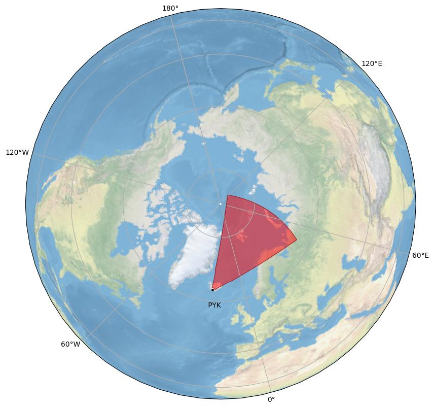

General Radar Info
Current Technical Info
|
||||||||||||||||||||||||||||||||||||||||||
| rkn | 65 | Rankin Inlet |
Dr. Glenn Hussey | University of Saskatchewan |
||||||||||||||||||||||||||||||||||||||
Rankin Inlet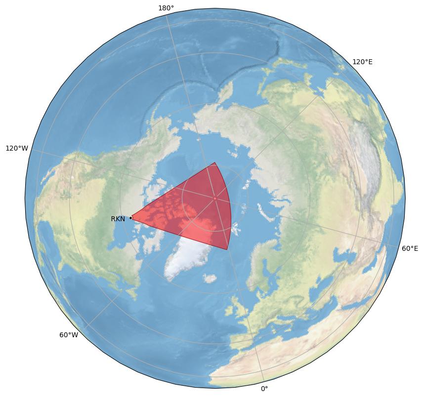
General Radar Info
Current Technical Info
|
||||||||||||||||||||||||||||||||||||||||||
| sas | t | 5 | Saskatoon |
Dr. Glenn Hussey | University of Saskatchewan |
|||||||||||||||||||||||||||||||||||||
Saskatoon
General Radar Info
Current Technical Info
|
||||||||||||||||||||||||||||||||||||||||||
| sch | s | 2 | Schefferville |
Dr. Christian Hanuise | CNRS/LPCE  |
|||||||||||||||||||||||||||||||||||||
Schefferville

General Radar Info
Current Technical Info
|
||||||||||||||||||||||||||||||||||||||||||
| sto | w | 8 | Stokkseyri |
Dr. Jim Wild | Lancaster University |
|||||||||||||||||||||||||||||||||||||
Stokkseyri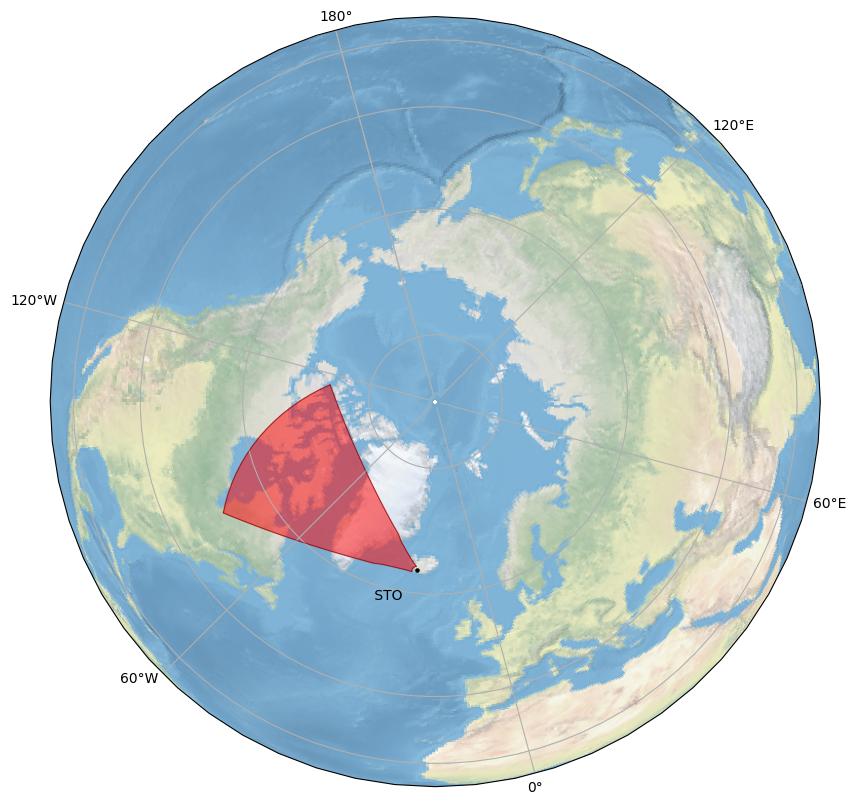

General Radar Info
Current Technical Info
|
||||||||||||||||||||||||||||||||||||||||||
| sze | 53 | Siziwang East |
Dr. J.J. Zhang | Chinese Academy of Sciences |
||||||||||||||||||||||||||||||||||||||
Siziwang East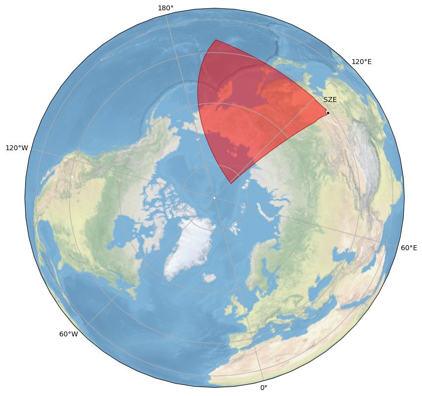
General Radar Info
Current Technical Info
|
||||||||||||||||||||||||||||||||||||||||||
| szw | 54 | Siziwang West |
Dr. J.J. Zhang | Chinese Academy of Sciences |
||||||||||||||||||||||||||||||||||||||
Siziwang West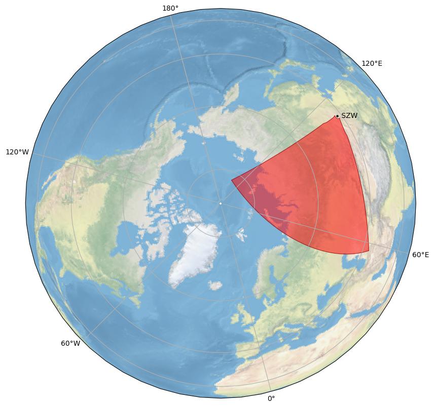
General Radar Info
Current Technical Info
|
||||||||||||||||||||||||||||||||||||||||||
| wal | i | 32 | Wallops Island |
Dr. Alex Chartier | JHU/APL |
|||||||||||||||||||||||||||||||||||||
Wallops Island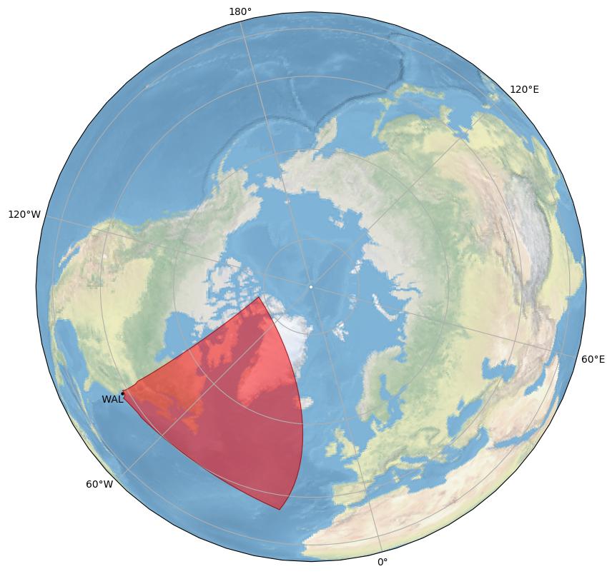
General Radar Info
Current Technical Info
|
||||||||||||||||||||||||||||||||||||||||||
Southern Hemisphere Radars
| Code | Station ID | Radar, Country Located | PI | Institution, Country | ||||||||||||||||||||||||||||||||||||||
|---|---|---|---|---|---|---|---|---|---|---|---|---|---|---|---|---|---|---|---|---|---|---|---|---|---|---|---|---|---|---|---|---|---|---|---|---|---|---|---|---|---|---|
| bpk | 24 | Buckland Park  |
Dr. John Devlin | La Trobe University  |
||||||||||||||||||||||||||||||||||||||
Buckland Park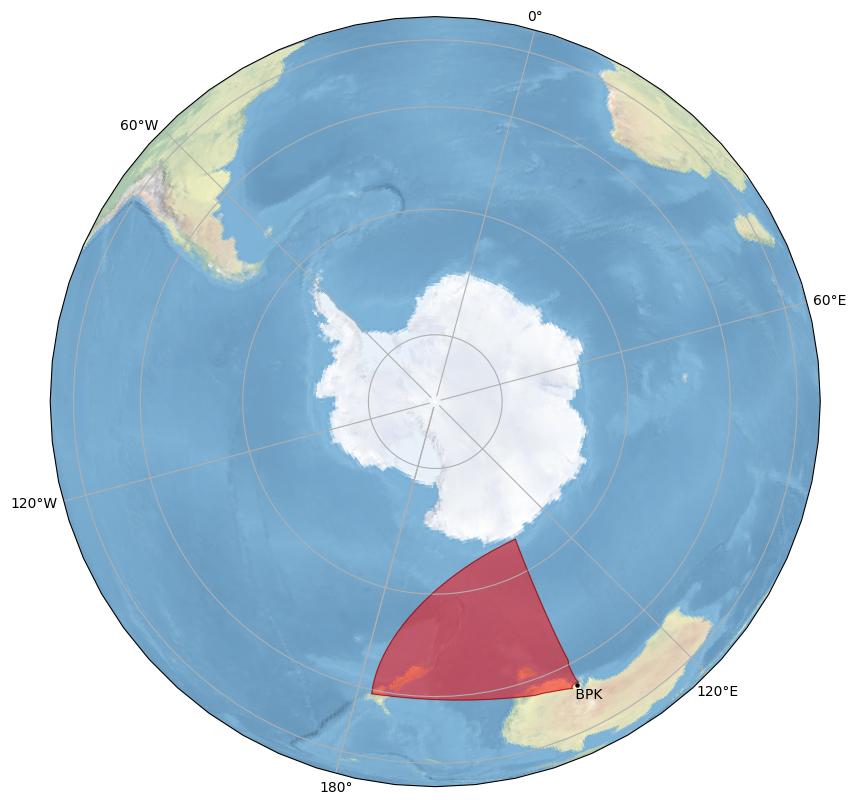
Buckland Park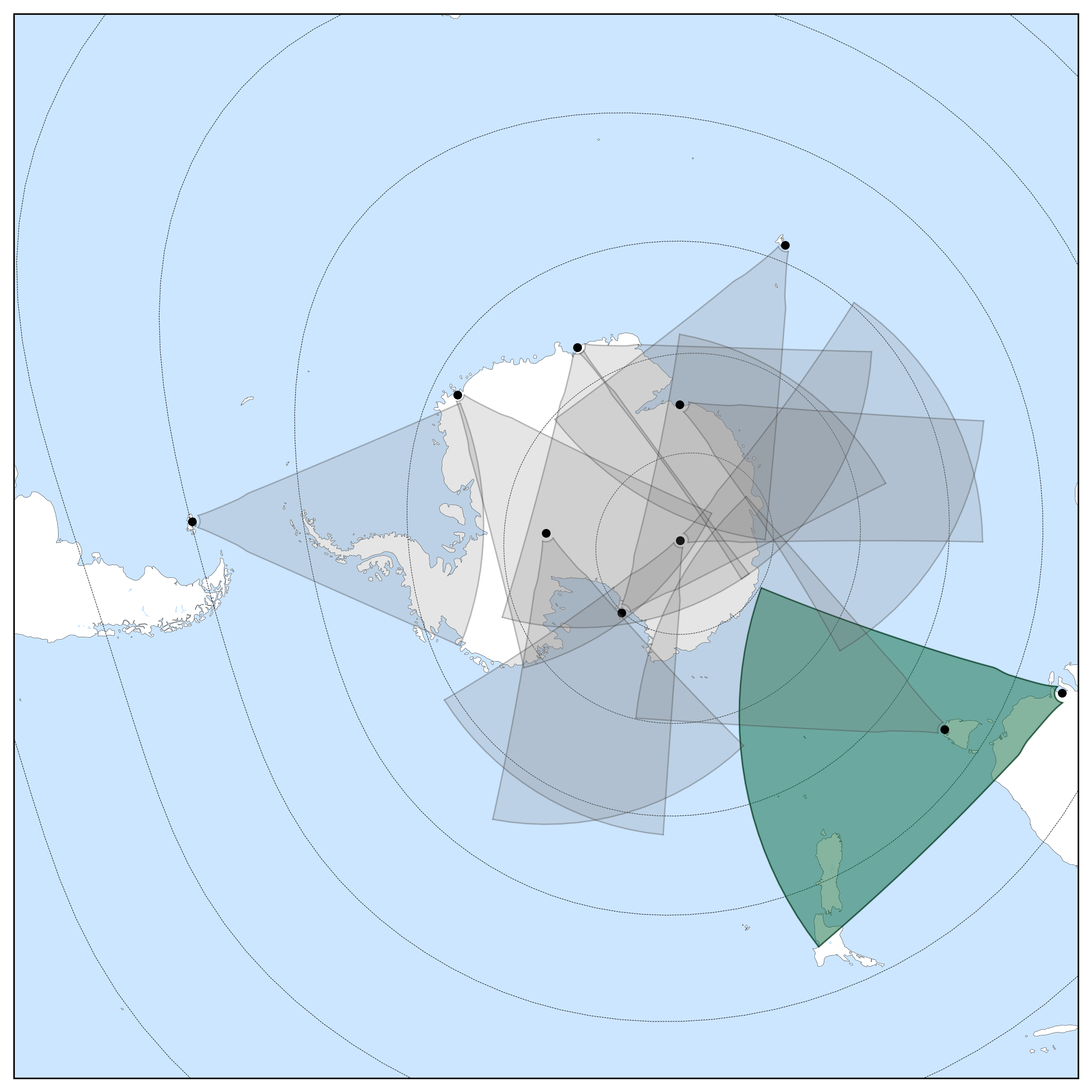
General Radar Info
Current Technical Info
|
||||||||||||||||||||||||||||||||||||||||||
| dce | 96 | Dome C East  |
Dr. Stefano Massetti | IAPS  |
||||||||||||||||||||||||||||||||||||||
Dome C East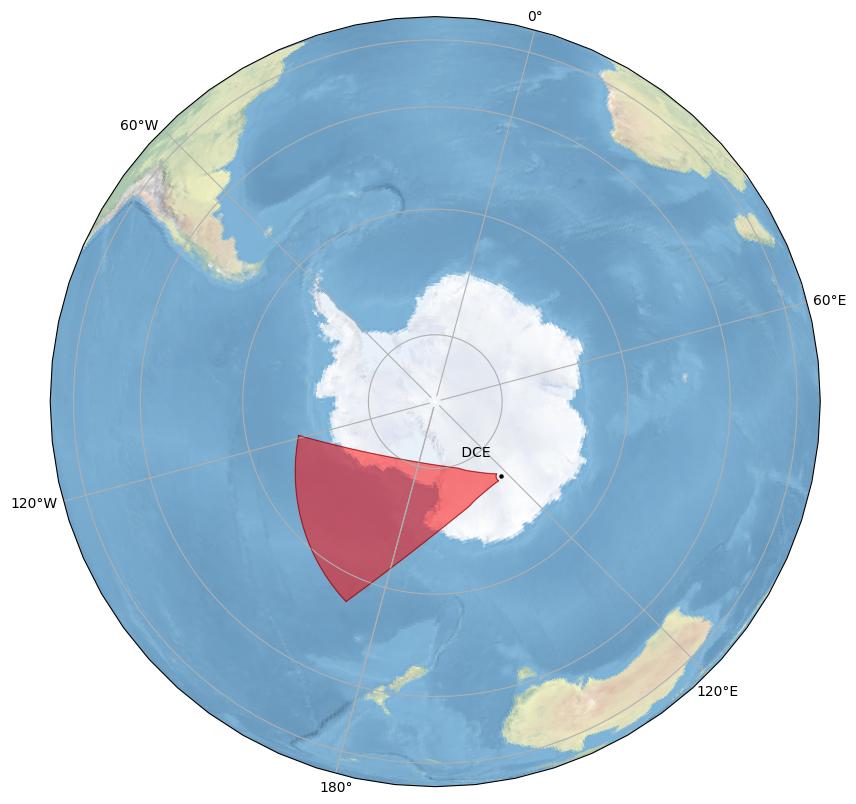
Dome C East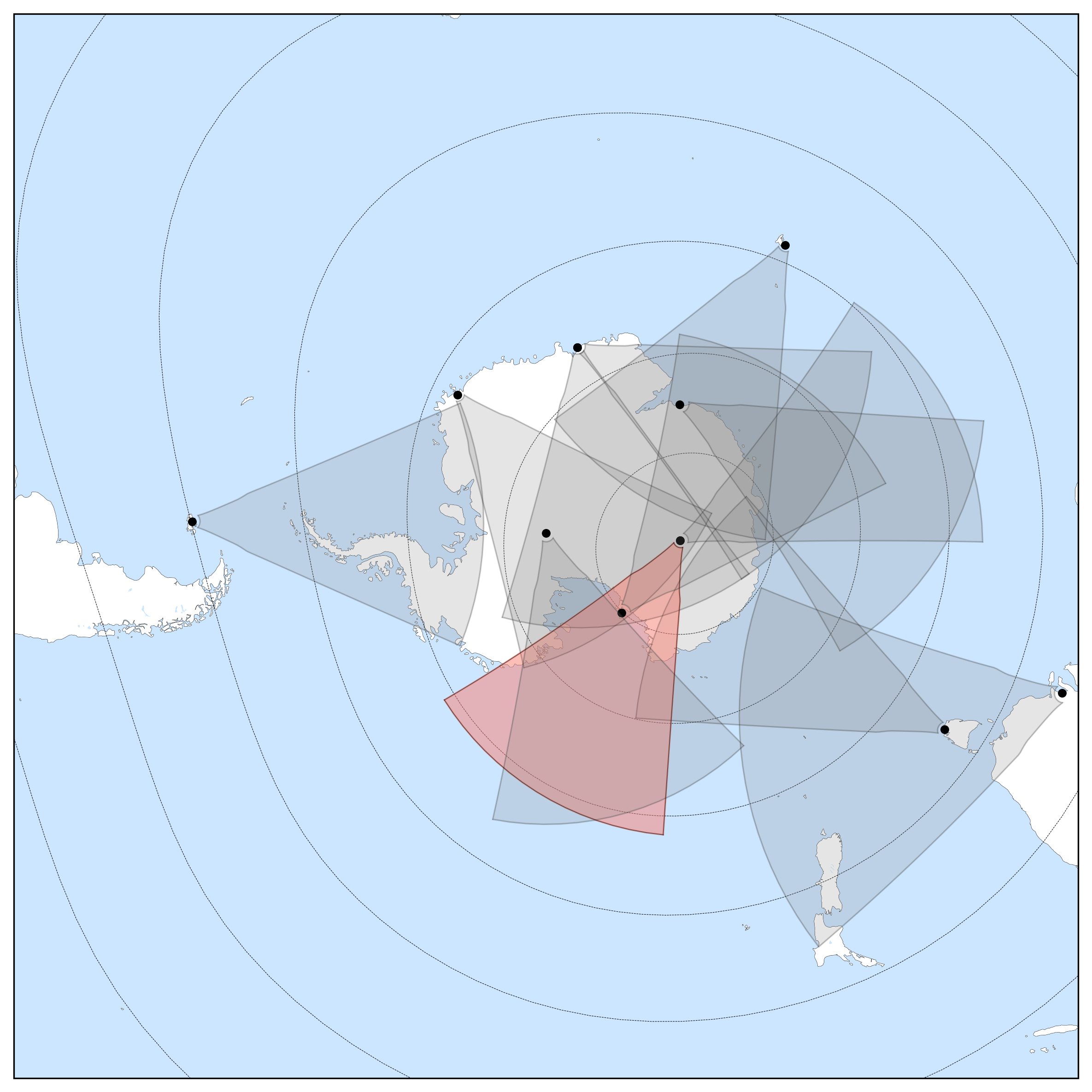
General Radar Info
Current Technical Info
|
||||||||||||||||||||||||||||||||||||||||||
| dcn | 97 | Dome C North |
Dr. Stefano Massetti | IAPS |
||||||||||||||||||||||||||||||||||||||
Dome C North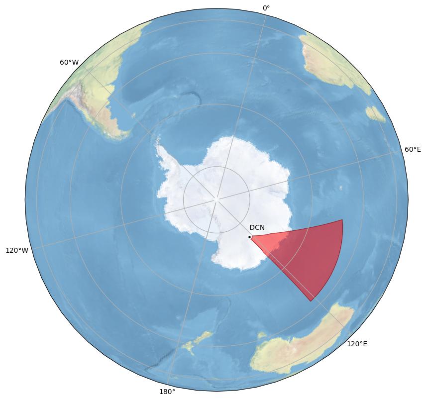
Dome C North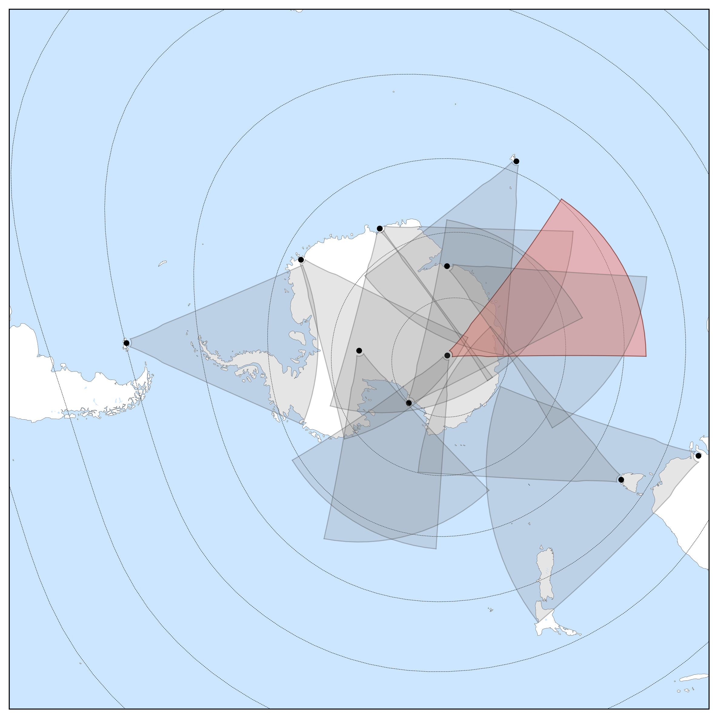
General Radar Info
Current Technical Info
|
||||||||||||||||||||||||||||||||||||||||||
| fir | 21 | Falkland Islands  |
Dr. Gareth Chisham | British Antarctic Survey |
||||||||||||||||||||||||||||||||||||||
Falkland Islands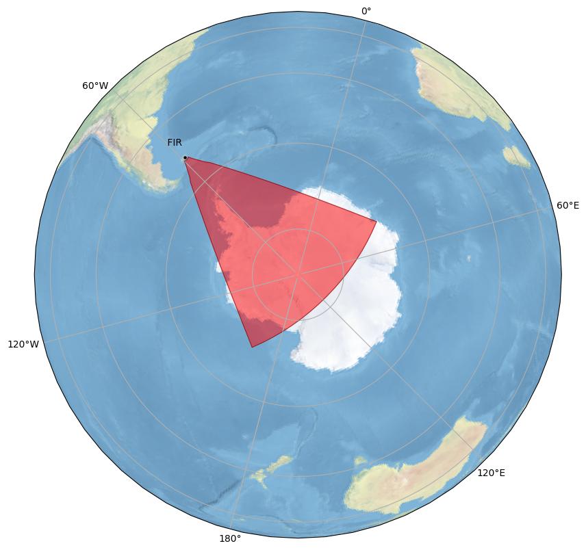
Falkland Islands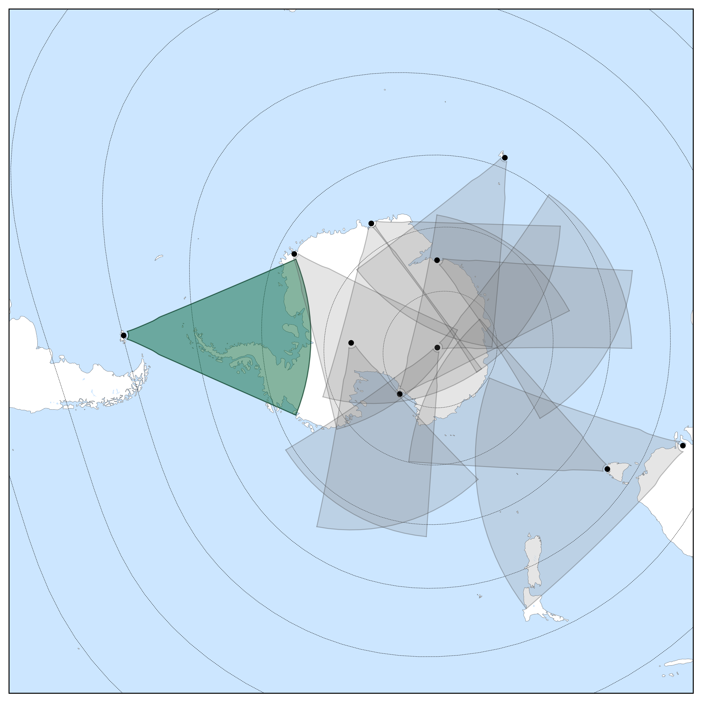
General Radar Info
Current Technical Info
|
||||||||||||||||||||||||||||||||||||||||||
| hal | h | 4 | Halley |
Dr. Gareth Chisham | British Antarctic Survey |
|||||||||||||||||||||||||||||||||||||
Halley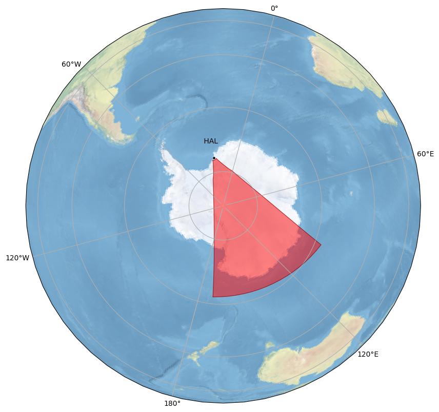
Halley
General Radar Info
Current Technical Info
|
||||||||||||||||||||||||||||||||||||||||||
| ker | p | 15 | Kerguelen  |
Dr. Aurélie Marchaudon | IRAP/CNRS/IPEV |
|||||||||||||||||||||||||||||||||||||
Kerguelen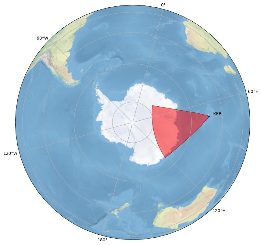
Kerguelen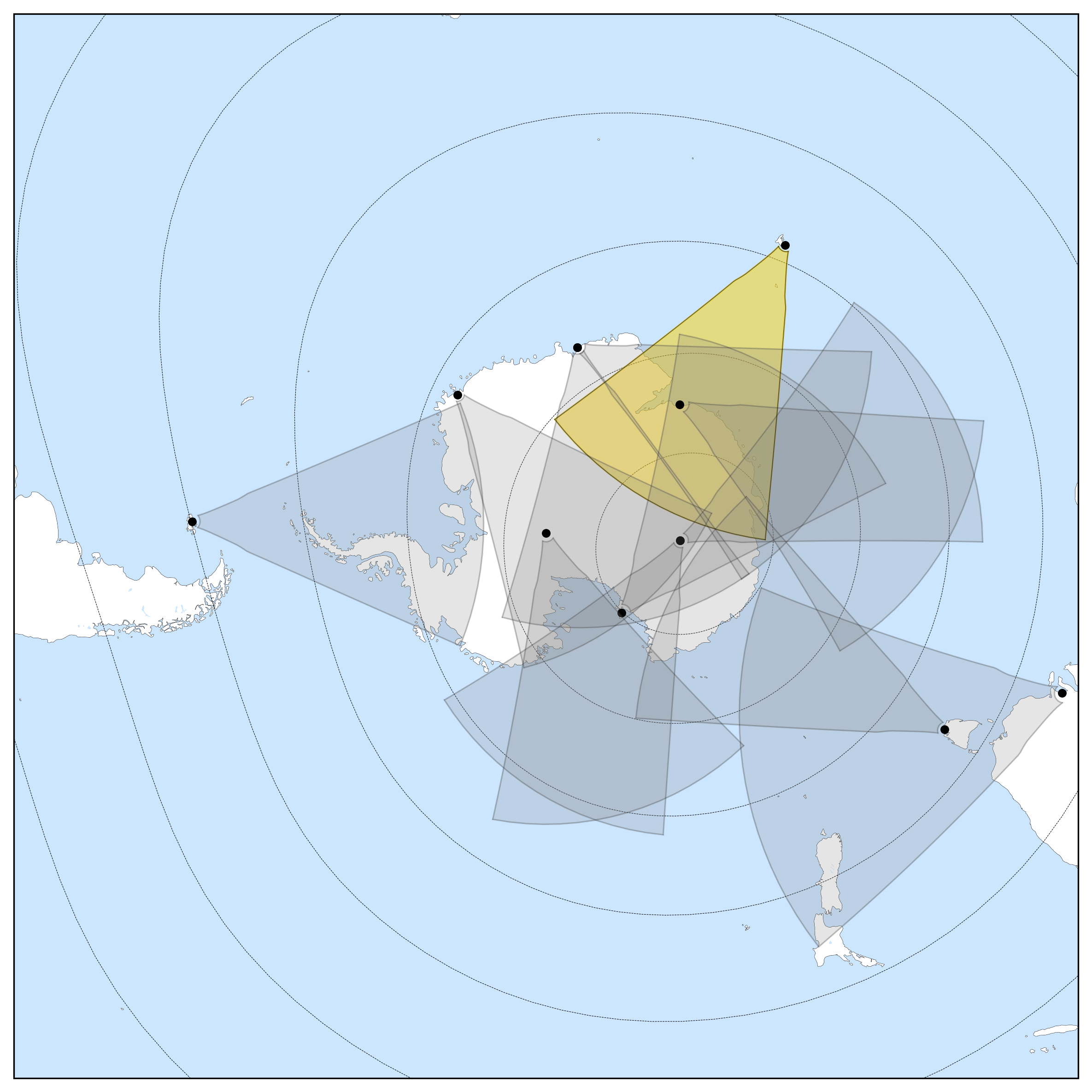
General Radar Info
Current Technical Info
|
||||||||||||||||||||||||||||||||||||||||||
| mcm | 20 | McMurdo |
Dr. Bill Bristow | Penn State University |
||||||||||||||||||||||||||||||||||||||
McMurdo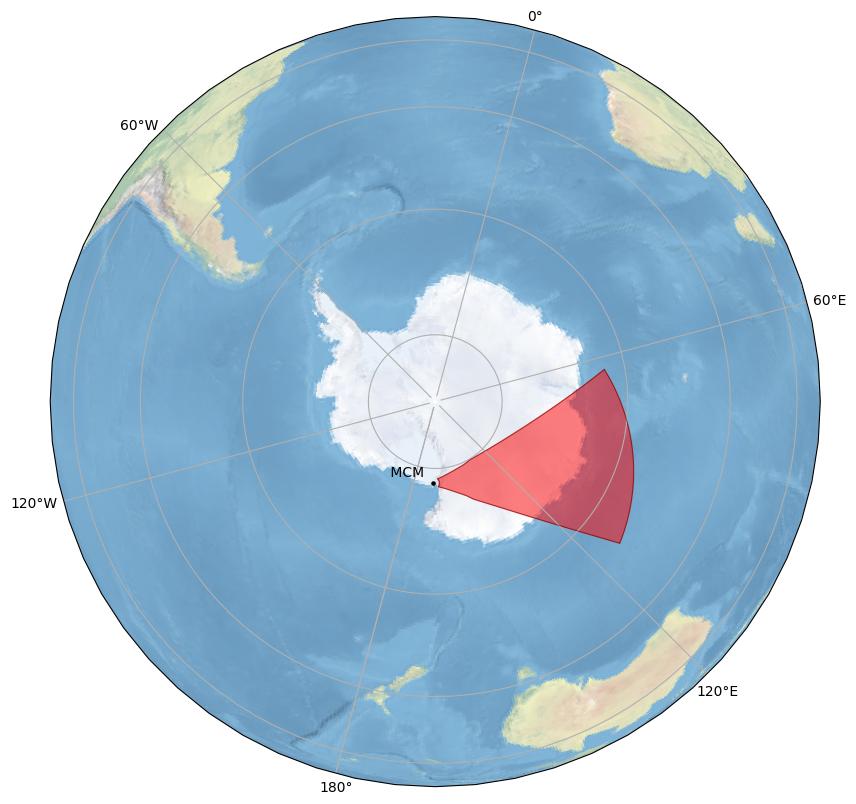
McMurdo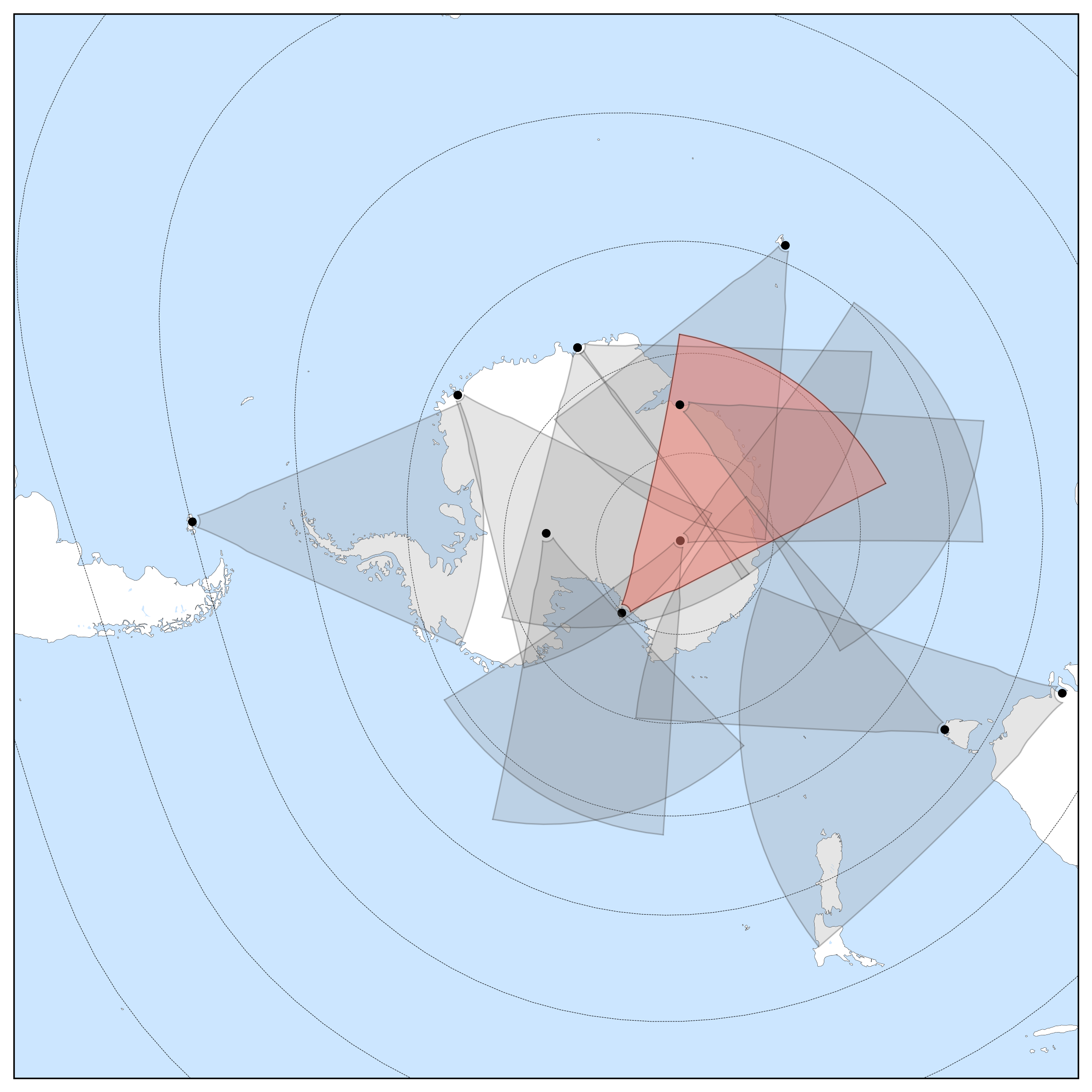
General Radar Info
Current Technical Info
|
||||||||||||||||||||||||||||||||||||||||||
| san | d | 11 | SANAE |
Dr. Mike Kosch | South African National Space Agency  |
|||||||||||||||||||||||||||||||||||||
SANAE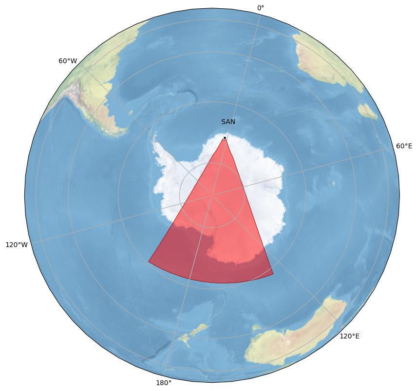
SANAE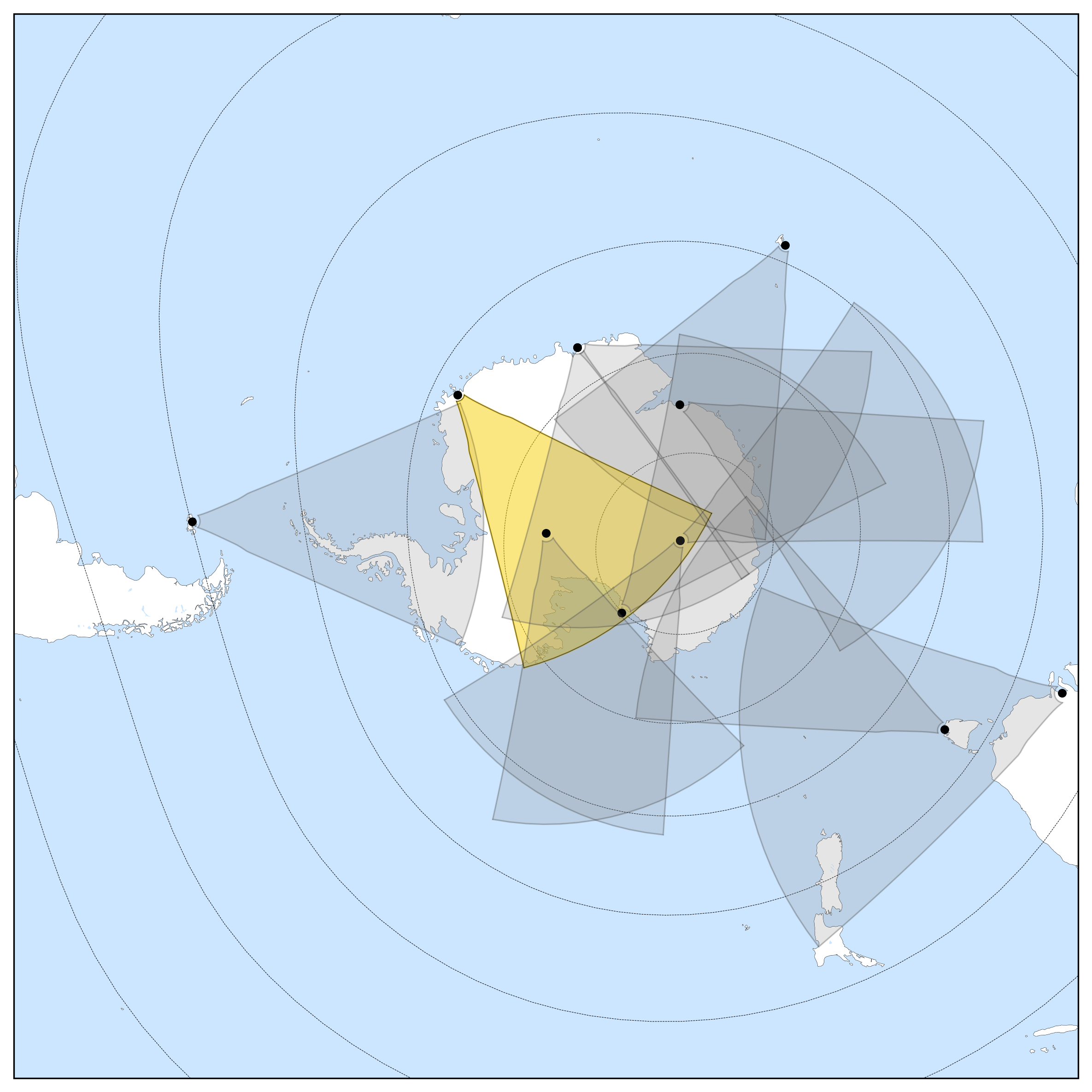
General Radar Info
Current Technical Info
|
||||||||||||||||||||||||||||||||||||||||||
| sps | 22 | South Pole Station |
Dr. Bill Bristow | Penn State University |
||||||||||||||||||||||||||||||||||||||
South Pole Station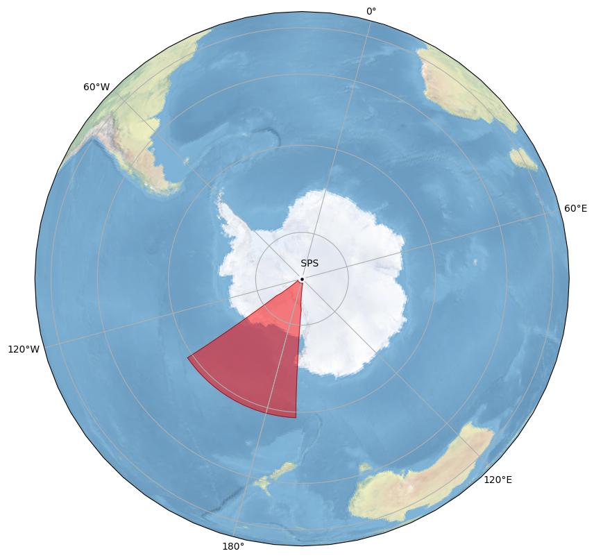
South Pole Station
General Radar Info
Current Technical Info
|
||||||||||||||||||||||||||||||||||||||||||
| sye | n | 13 | Syowa East |
Dr. Akira Sessai Yukimatu | National Institute of Polar Research |
|||||||||||||||||||||||||||||||||||||
Syowa East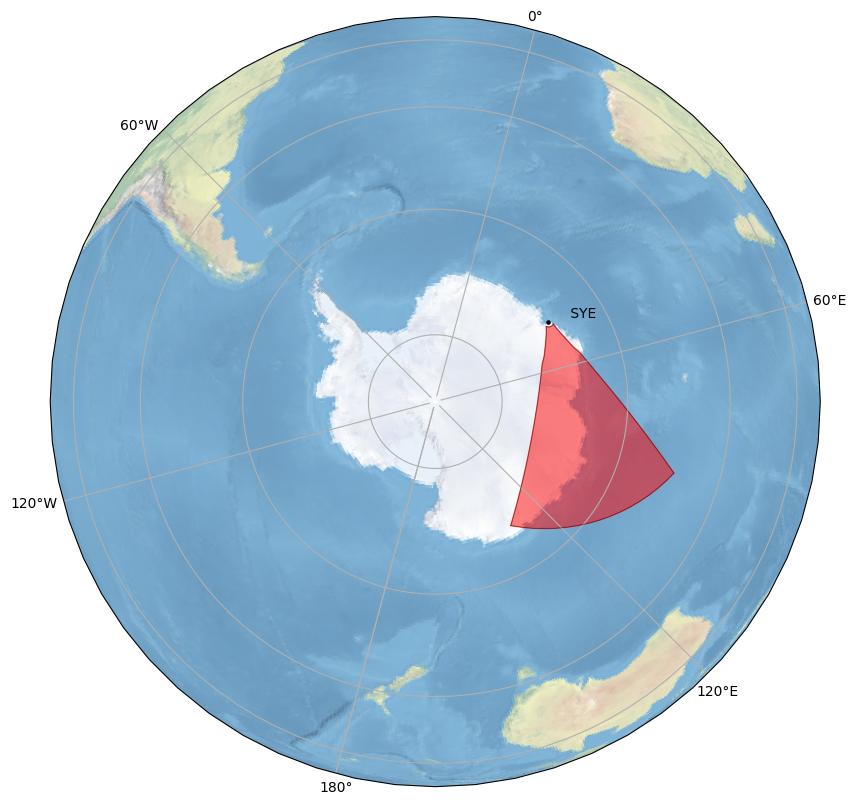
Syowa East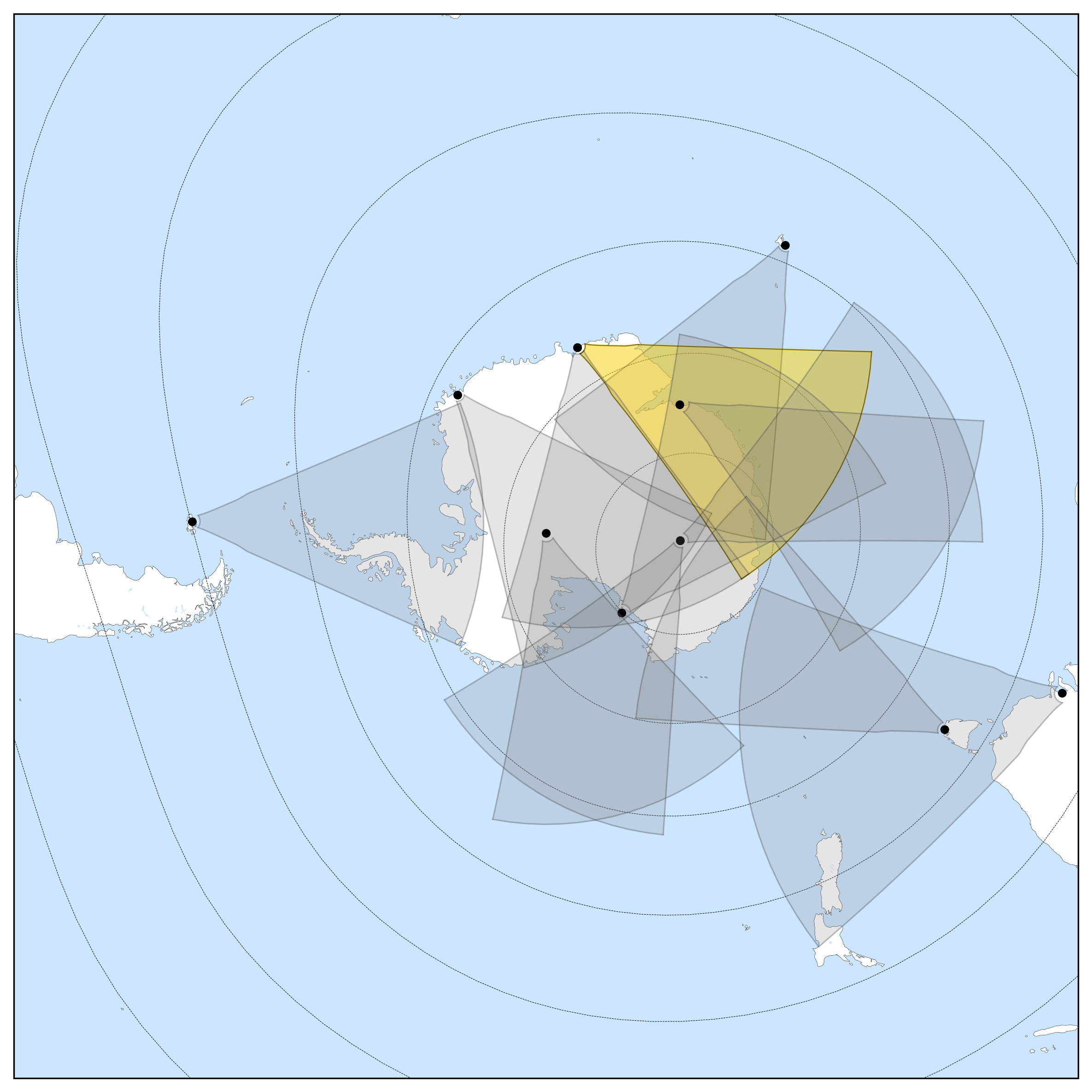
General Radar Info
Current Technical Info
|
||||||||||||||||||||||||||||||||||||||||||
| sys | j | 12 | Syowa South |
Dr. Akira Sessai Yukimatu | National Institute of Polar Research |
|||||||||||||||||||||||||||||||||||||
Syowa South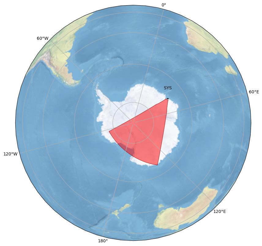
Syowa South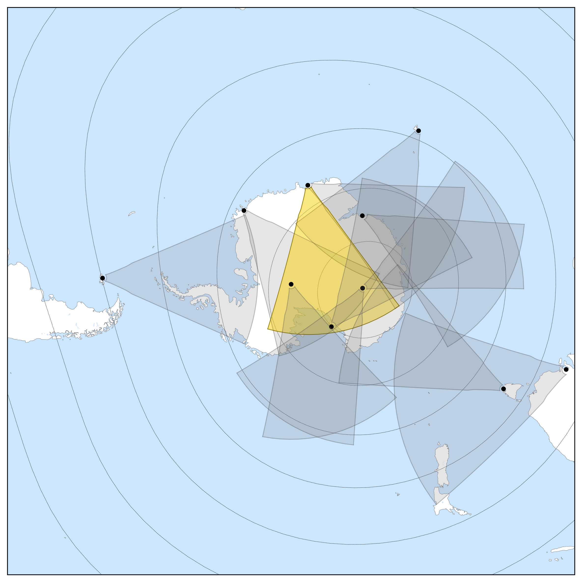
General Radar Info
Current Technical Info
|
||||||||||||||||||||||||||||||||||||||||||
| tig | r | 14 | Tiger |
Dr. John Devlin | La Trobe University |
|||||||||||||||||||||||||||||||||||||
Tiger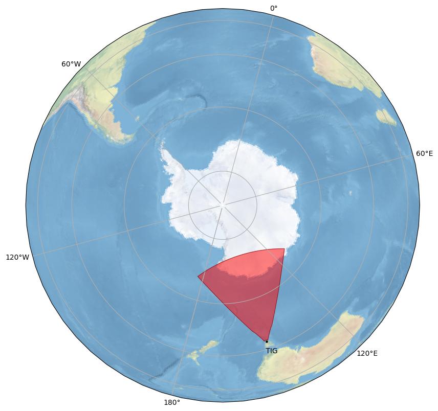
Tiger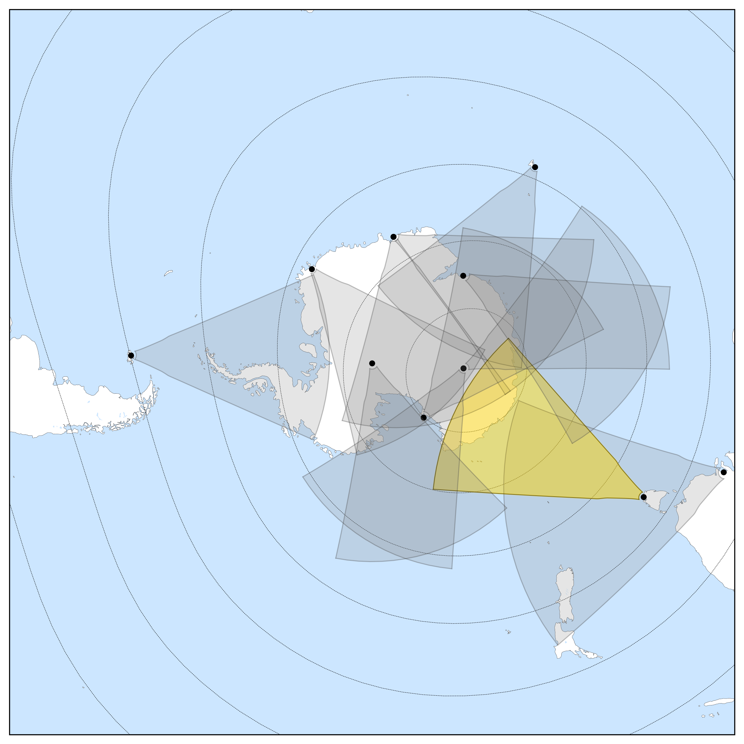
General Radar Info
Current Technical Info
|
||||||||||||||||||||||||||||||||||||||||||
| unw | u | 18 | Unwin  |
Dr. John Devlin | La Trobe University |
|||||||||||||||||||||||||||||||||||||
Unwin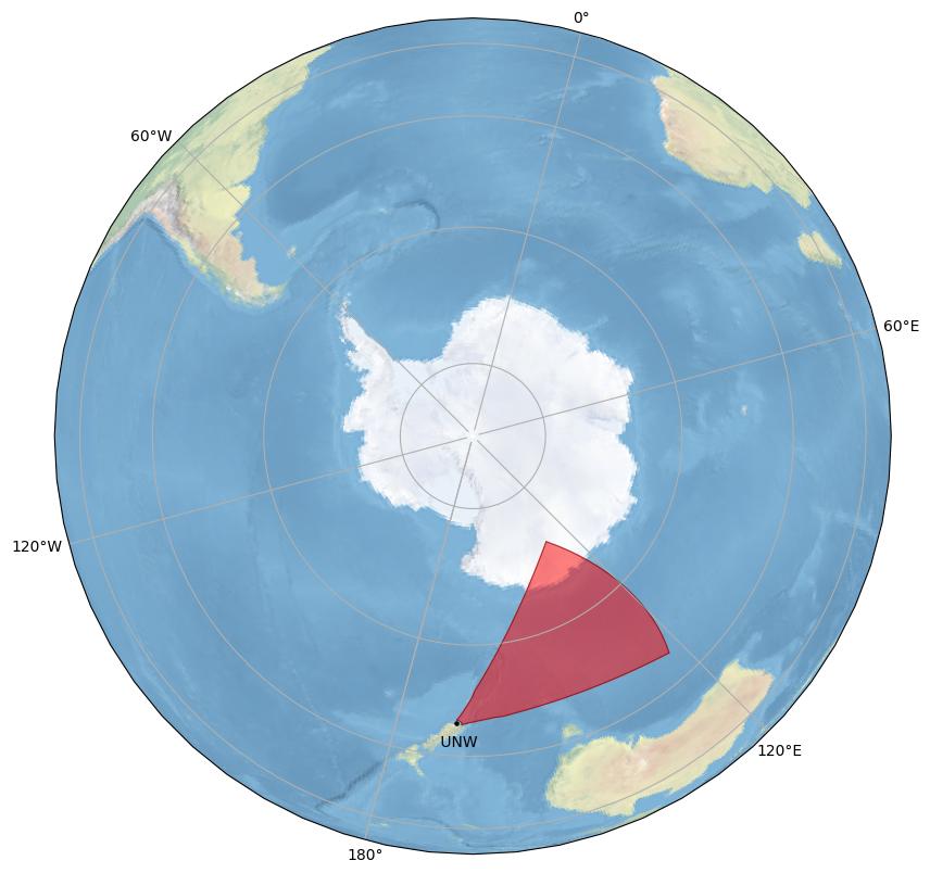
Unwin
General Radar Info
Current Technical Info
|
||||||||||||||||||||||||||||||||||||||||||
| zho | 19 | Zhongshan |
Dr. Hongqiao Hu | Polar Research Institute of China |
||||||||||||||||||||||||||||||||||||||
Zhongshan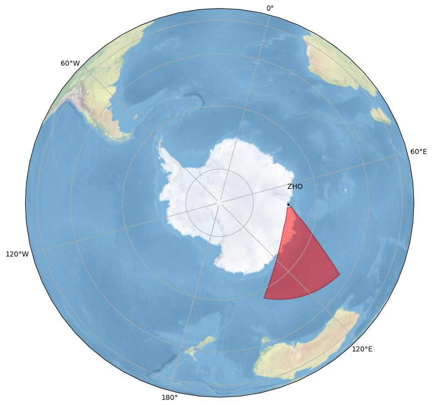
Zhongshan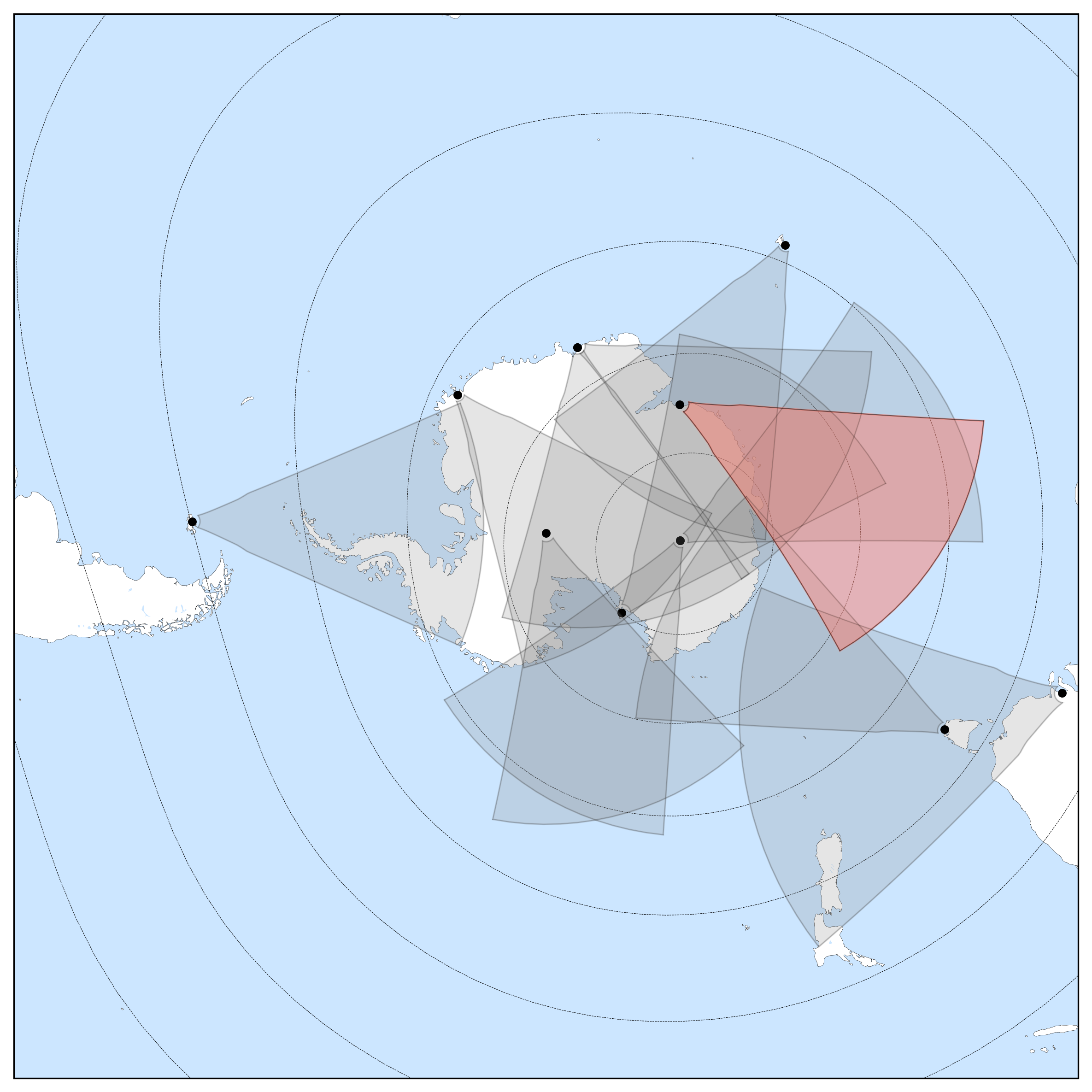
General Radar Info
Current Technical Info
|
||||||||||||||||||||||||||||||||||||||||||
Parameter Descriptions
| Parameter | Description |
|---|---|
| Code | Three letter code designated to each radar. If applicable, old single letter code shown in italics to right. |
| Station ID | Unique numerical value assigned to each radar. |
| Geographic Latitude/Longitude | Geographic latitude is the measurement of distance north or south of the Equator in degrees. Latitude is positive north of the equator and negative south of the equator. A value of 0° is the equator, a value of 90° is the Geographic North Pole, and conversely -90° is the Geographic South Pole. Geographic longitude is the distance in degrees east or west of the Prime Meridian, the imaginary line between the North and South pole that goes through Greenwich in the U.K. (as is the convention). West longitudes are negative in this instance. |
| Geomagnetic Latitude/Longitude | The magnetic poles of Earth are offset from the Geographic poles, as such the Geomagnetic potision on Earth is slightly different and defined through the Geomagnetic poles which are found as the axis of the geomagnetic dipole. To further complicate this picture, the geomagntic poles also drift. To read more on geomagnetic poles and drift see this article. The magnetic field values presented here are calculated using the AACGM, and may deviate from the exact true value at time of reading. We advise that you calculate your own Geomagnetic coordinates for the specific time periods of your study if being used for scientific purposes, the values quoted here are for general reference only. |
| Boresite | Direction of the center beam, measured in degrees relative to geographic north. |
| Elevation | Height of radar in meters above sea level. |
| Beams | The maximum number of beams the radar can form. Usually between 16 and 24. (It is important to specify the true maximum. This will assure that a given beam number always points in the same direction. A subset of these beams, e.g. 8-23, can be used for standard 16 beam operation.) |
| Gates | The maximum number of range gates from which the radar can receive data. Usually between 75 and 225. (This is used for allocation of array storage.) |
| Starting Year | Year at which the radar begin taking data. |
| Config Valid From | As the current configuration is shown, this parameter denotes when this configuration started. 'Start' denotes that the configuration has not changed since the construction fo the radar. |
| Beam Separation | Angular separation in degrees between adjacent beams. Normally 3.24 degrees |
| Velocity Sign | The sign of the velocity direction, either +1 or -1, usually +1.(At the radar level, backscattered signals with frequencies above the transmitted frequency are assigned positive Doppler velocities while backscattered signals with frequencies below the transmitted frequency are assigned negative Doppler velocity. This convention can be reversed by changes in receiver design or in the data samping rate. This parameter is set to +1 or -1 to maintain the convention.) |
| TDiff | Propagation time from interferometer array antenna to phasing matrix input minus propagation time from main array antenna through transmitter to phasing matrix input. If the signal from the interferometer comes first, then tdiff < 0 |
| Phase Sign | The sign of the phase shift between interferometer and main array, either +1 or -1, usually +1. (Cabling errors can lead to a 180 degree shift of the interferometry phase measurement. +1 indicates that the sign is correct, -1 indicates that it must be flipped. |
| Interferometer Position | Displacement of midpoint of interferometer array from midpoint of main array. This is given in meters in Cartesian coordinates. X is along the line of antennas with +X toward higher antenna numbers, Y is along the array normal direction with +Y in the direction of the array normal. Z is the altitude difference, +Z up. |
| *Attenuation Step | *For analog receivers* The step size of the receiver attenuation in dB. |
| *Attentuation Stages | *For analog receivers* The maximum number of steps of analog attenuation in the receiver. (This is used for gain control of an analog receiver or front-end.) |
| *Receiver Rise Time | *For analog receivers* The rise time of the analog receiver, in microseconds. (Time delays of less than ~10 microseconds can be ignored. If narrow-band filters are used in analog receivers or front-ends, the time delays should be specified.) |
Further InformationPrevious configurations can be found in the hardware files for each radar, which can be found on the SuperDARN Github or by contacting the radars PI, found in the above tables. This information is updated frequently using pyDARN and the AACGM Python wrapper. The DOI's for these software tools are pyDARN: |
|
Powered by:
Flag icons made by Freepik from www.flaticon.local